Navigating the Skies Together: Airborne Lidar with ClearSkies Geomatics and Phoenix Lidar Systems
Lidar


We first started to talk to Phoenix Lidar Systems about their line of airborne lidar products at Geoweek in Denver in 2022.
I loved touring their booth because I could see the progression of the full Ranger series of lidar systems, from the miniRanger to the Ranger LR and Ranger Ultra.
At GeoWeek 2023, Rob Dannenberg (COO at Phoenix) and I sat down for lunch and started to outline a plan for how we could work together.
We quickly developed a unique partnership that became the catalyst for collaboration and growth for both companies.
This article shares the strategic alliance between ClearSkies Geomatics and Phoenix Lidar Systems, shedding light on the mutual benefits and shared values that we believe will bring a new level of value to our clients.
A Broad Spectrum of Expertise
ClearSkies Geomatics has a firmly established presence in the manned aerial survey market, specializing in buying, selling, and renting new and pre-owned aerial survey equipment to our clients across the globe.
We are proud of our network of clients doing some of the most important surveying projects in the world.
Our clients range from single aircraft operators to large “Primes” with fleets and dozens of sensors. Likewise, we’ve helped clients purchase their first airborne lidar systems as they begin to break into the aerial survey industry as well as those clients who have been doing this work for decades.
Meanwhile, Phoenix Lidar Systems is a leader in UAV lidar mapping solutions by focusing on integrating industry-leading products into flexible, turnkey lidar systems.
%2520(1).png)
Phoenix LiDAR payloads easily integrate with multiple platforms including multi-rotor and fixed wing UAS, vehicles, backpacks, and manned aircraft such as helicopters and small fixed wing aircraft, allowing data collection across a wide range of applications.
The synergy between ClearSkies and Phoenix is not just a collaboration; it's a strategic alignment that spans the spectrum of client needs.
Together, we can support clients acquiring mapping data with drones, those conducting wide-area mapping with aircraft, and everything in between. This comprehensive approach ensures that clients receive tailored solutions regardless of the scale or nature of their projects.
Building on a Foundation of Trust
One of the key pillars supporting this partnership is Phoenix Lidar Systems' successful history of integrating products that ClearSkies Geomatics holds in high regard.
Brands such as Riegl, Phase One, Novatel, and Somag are not just names; they represent a legacy of quality and innovation.
We often encounter scenarios where clients come to us to help them sell their raw sensors or incomplete systems.
When we find a buyer for that sensor, if they need a complete lidar system, it can be challenging to find a compatible used GPS/IMU or Flight Management System to integrate.
.png)
With Phoenix Lidar Systems as a partner, we can add the necessary components into deliverables, enabling the creation of a complete turnkey airborne lidar system at an affordable price.
By collaborating with Phoenix, ClearSkies can help our clients access high accuracy integrated turnkey lidar solutions, ensuring that clients benefit from the best-in-class technology available.
Crafting Complete Solutions
For clients new to aerial survey, their journey often begins with a call to ClearSkies Geomatics. We share our perspective on what equipment might best suit their needs and budget. The partnership with Phoenix becomes instrumental in crafting holistic solutions that encompass everything needed to get up and running, including comprehensive training.
This collaborative approach ensures that clients, regardless of their familiarity with lidar technology, receive a complete package that empowers them to harness the full potential of their systems.
ClearSkies Geomatics will focus on marketing the Phoenix Lidar Systems for our manned aerial and mobile mapping survey clients.
We will be featuring each of through LinkedIn posts and some blog articles to educate clients about these systems and which applications they are most suited to support.
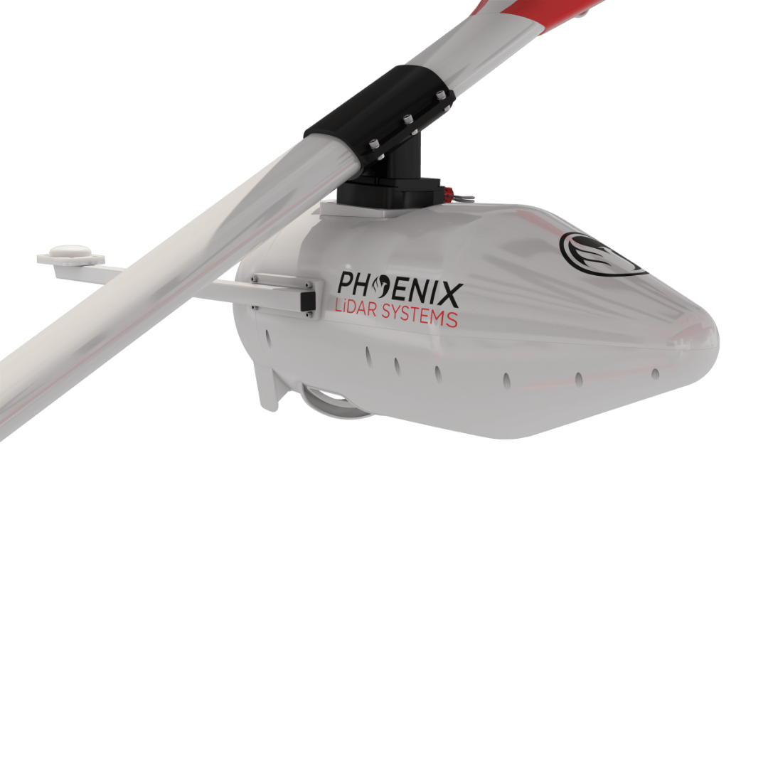
Ranger XL: The Ranger XL is a nimble airborne lidar scanner suitable for use in small manned airplanes and helicopters. Boasting a 75-degree field of view and data acquisition rate reaching up to 1800 kHz, the Ranger XL is an ideal solution for precision corridor mapping projects. Its exceptional high point density makes it a perfect match for power line, railway track, and pipeline inspections.
Ranger U-16023: This lidar features a distinctive forward and rear-looking field of view which minimizes laser shadowing and delivers intricate details on vertical surfaces.
.png)
With pulse rates reaching up to 2400 kHz and compatibility with a range of aircraft including helicopter and small fixed wing aircraft, the RANGER-U16023 stands out as an exceptionally versatile solution. Tailored to meet diverse project objectives, this system is well-suited for corridor mapping tasks, including utility, rail, and pipeline inspections.
Halo: This is a new sensor in the Phoenix lineup, and we’re excited about it because it’s an extremely affordable option for clients looking for a turnkey lidar system for manned aircraft. Tailored for high-altitude, high-efficiency mapping, the HALO series airborne lidar scanners redefine the possibilities of city-scale projects. With swath widths of up to 4,000 m, these scanners effortlessly support city-scale lidar mapping endeavors. Selectable measurement rates up to 1 MHz and line speed up to 250 per second.
UltraPod UP1: Flying a Cessna 172, 182, or 206? The ULTRAPOD is FAA and EASA approved. The pod provides operators with a user-friendly and flexible mounting solution for LiDAR payloads and cameras.
RANGER FLEX DUAL MOBILE SYSTEM RFM2-UAV22: The RFM2-UAV22 scanner mobile accessory kit transforms two RANGER-UAV22 FLEX scanners into a high-performance dual scanner mobile system.
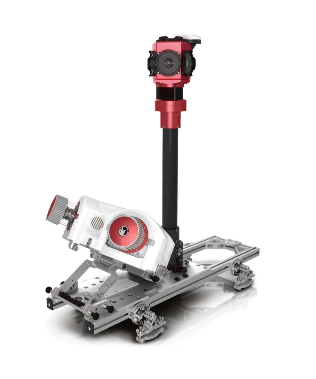
The dual scanners' strategic physical arrangement is designed to deliver significant time savings on-site while ensuring comprehensive point coverage, achieving an impressive speed of up to 2.4 million measurements per second.
Built with flexibility in mind, the standalone RANGER-UAV22 FLEX payload acts as the central control unit within the dual scanner mobile accessory. When detached, it transforms into a versatile tool for backpack and UAV applications, adding an extra layer of adaptability to your toolkit.
Ranger LR22 Lite: This airborne lidar system is one of our favorites because it’s the epitome of versatility in mapping systems. It features a powerful 1,550 nm laser and up to 15 returns, making it a great solution for high density and long-range lidar projects, especially when it comes to penetrating dense vegetation or corridor mapping with a helicopter.
Software and Workflow
To support acquisition planning, mission planning and post-processing, we also consult with clients about their software options. Phoenix lidar systems can be sold with a variety of software packages such as:
- Spatial Explorer for configuration and control of the lidar system
- Spatial Pro which includes calibration, analytics and reporting
- NavLab Embedded for seamless GNSS+INS trajectory processing
- LidarMill, which provides cloud-based post-processing
- Mission Guidance for flight planning
A Client-Centric Approach
Both ClearSkies Geomatics and Phoenix Lidar Systems share a fundamental commitment to putting clients first.
Our philosophy when selling to clients is to consult with them about their options by providing them with our manufacturer-neutral input on what we think will best suit their current and future needs.
If someone asks for a particular lidar that does not seem to align with their needs, we will discuss that with them and point them towards a better solution.
While making a sale is of course an important goal, the overarching priority for us is to consult with clients, guiding them towards systems that align best with their project requirements and budget constraints.
ClearSkies has observed the same client-centric approach as we’ve worked together on sales with Phoenix Lidar Systems.
Ultimately, both companies believe that helping our clients succeed in a way that builds long-term trust is the most important thing we do.
We feel confident when recommending Phoenix Lidar Systems to clients, knowing that they will receive top-quality airborne lidar equipment backed by warranty, robust software, efficient workflows, and exceptional customer support.
This alignment in values ensures that our clients’ experience extends beyond the purchase, fostering long-term partnerships built on trust, reliability, and shared success.
Conclusion
%2520(1).png)
Our industry depends on strong partnerships. We see this every day.
Primes partner with Subs.
Sensor owners partner with Platformers for data acquisition flights.
Manufacturers partner with Integrators.
Resellers partner with Manufacturers and Software companies.
In a small niche industry like ours, we depend on each other to succeed. Strong partnerships transcend traditional boundaries and become the driving force behind progress.
The collaboration between ClearSkies Geomatics and Phoenix Lidar Systems exemplifies the synergy that can be achieved when industry leaders join forces.
As we continue to navigate the airborne lidar market together, clients can expect excellence, innovation, and a commitment to delivering the best solutions at affordable prices.


Company
Aerial Survey Products
Aircraft Marketplace
Cookie Preferences
