Unique and Innovative Applications of Lidar Technology
General


Light Detection and Ranging (Lidar) is a technology that has come into the public eye with innovations in aerial surveys by using light from pulsed lasers to create highly detailed 3D models of buildings, terrain, and vegetation. Today, the highest-resolution models have an accuracy down to a single centimeter. Still, it might surprise you to learn that its legacy dates back decades.
Although the latest Apple Pro and Pro Max series incorporate a Lidar scanner, the technology has been used since the early 1960s, as part of the Hughes Aircraft Company. NASA also used it to map the surface of the moon for the Apollo 15 mission in 1971.
Lidar has so much more to offer. Here are some of the exciting uses Lidar has been used for in the modern era.
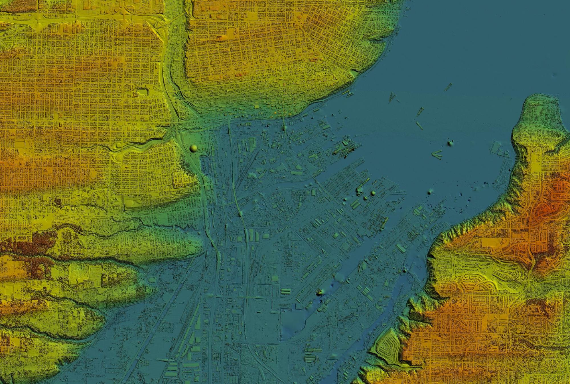
Coastline Mapping and Coastal Zone Management
With shipping lanes and ports busier than ever, the shipping industry is fast turning to Lidar to enhance marine navigation. The technology is being utilized to provide high-resolution, navigational data to support both manned and unmanned vessels to detect obstacles and improve safety at sea.
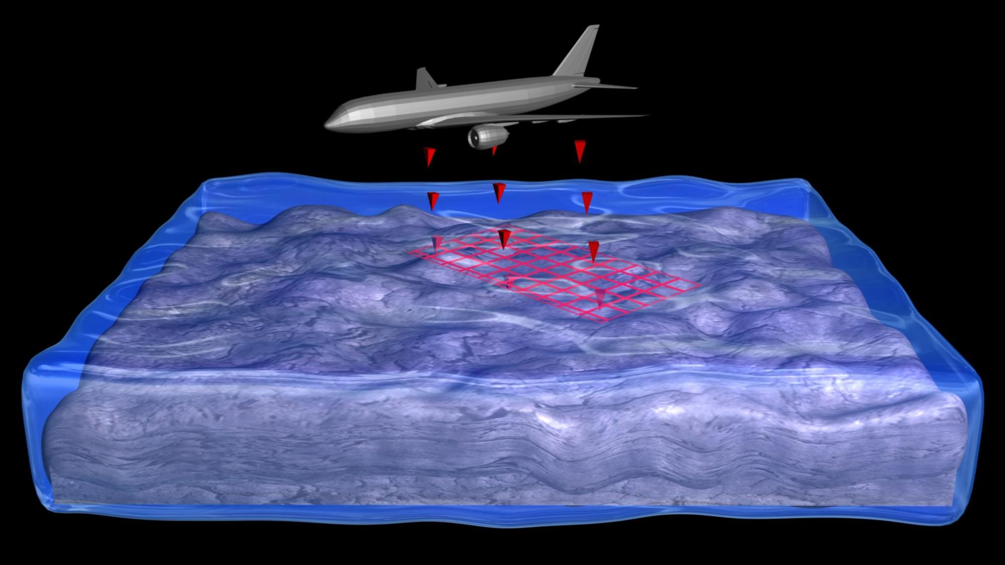
Additionally, coastal erosion, rising sea levels, and hurricane and tsunami risks are an increasing threat due to climate change. Lidar technology is an innovation that has enabled governments to track everything from the rate of coastal erosion to at-risk coastal areas. Coastal mapping often uses specialized topobathymetric lidar. These sensors measure both land and the sea floor to create accurate 3D maps of the coastline and seabed topography.
It’s also been deployed in the past to measure the impact of severe weather events on the coast. For example, after the catastrophe of Hurricane Ian, Lidar surveys were conducted to assess 2,400 structures for more accurate damage assessment and future recovery plans.
Aside from helping to support vulnerable coastal communities, the conservation industry has embraced Lidar for mapping threatened coastal habitats, forming a vital part of the ecosystem, including dunes, wetlands, and mangroves.
Archaeological Discoveries and Cultural Heritage Preservation
Just when you think we’ve explored the world, Lidar proves otherwise. Lidar has revolutionized archeology by providing professionals with a new weapon to uncover ancient structures from the earliest humans.
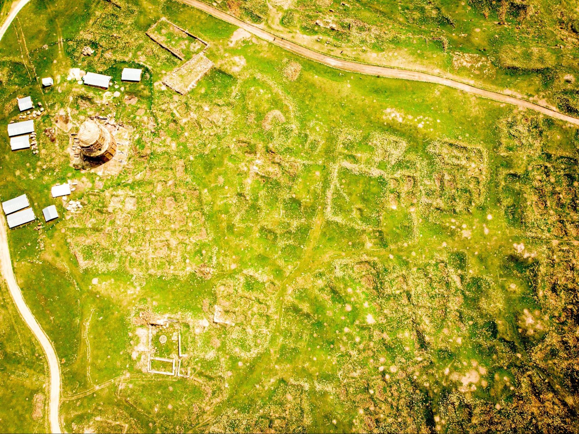
For example, an enormous Maya site in Northern Guatemala was found hidden under thousands of years of vegetation using Lidar, including intact pyramids and fortifications.
It’s also being used to preserve what we already have by helping formulate detailed 3D models of historical sites to support preservation, with organizations like the Smithsonian leading the way. Through digital preservation, Lidar offers the blueprints for future preservation efforts.
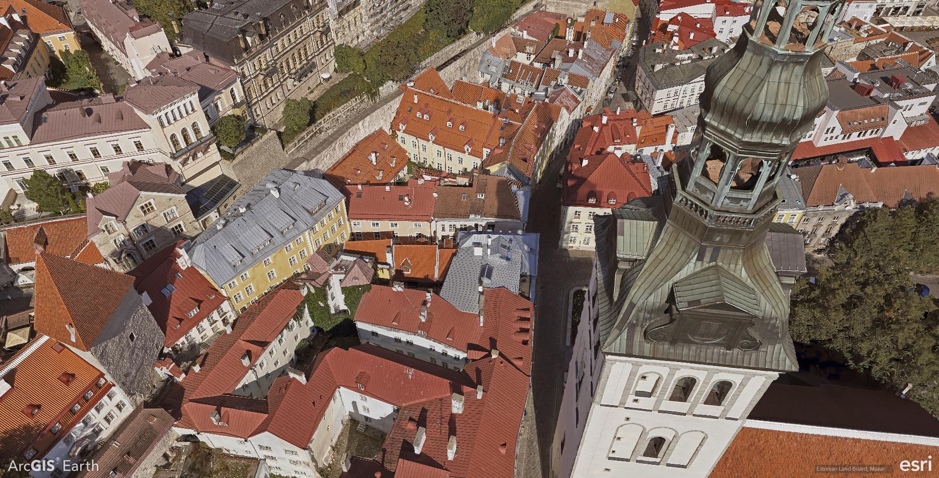
It’s even accurate enough to detect the subtle changes in degrading monuments that a human eye would otherwise miss, helping us spot when human and environmental changes threaten our cultural heritage. One such example is the historic city of Koszalin, Poland, where low-cost Lidar tools have been used to create 3D models of the city’s crumbling medieval walls to assist in regeneration work.
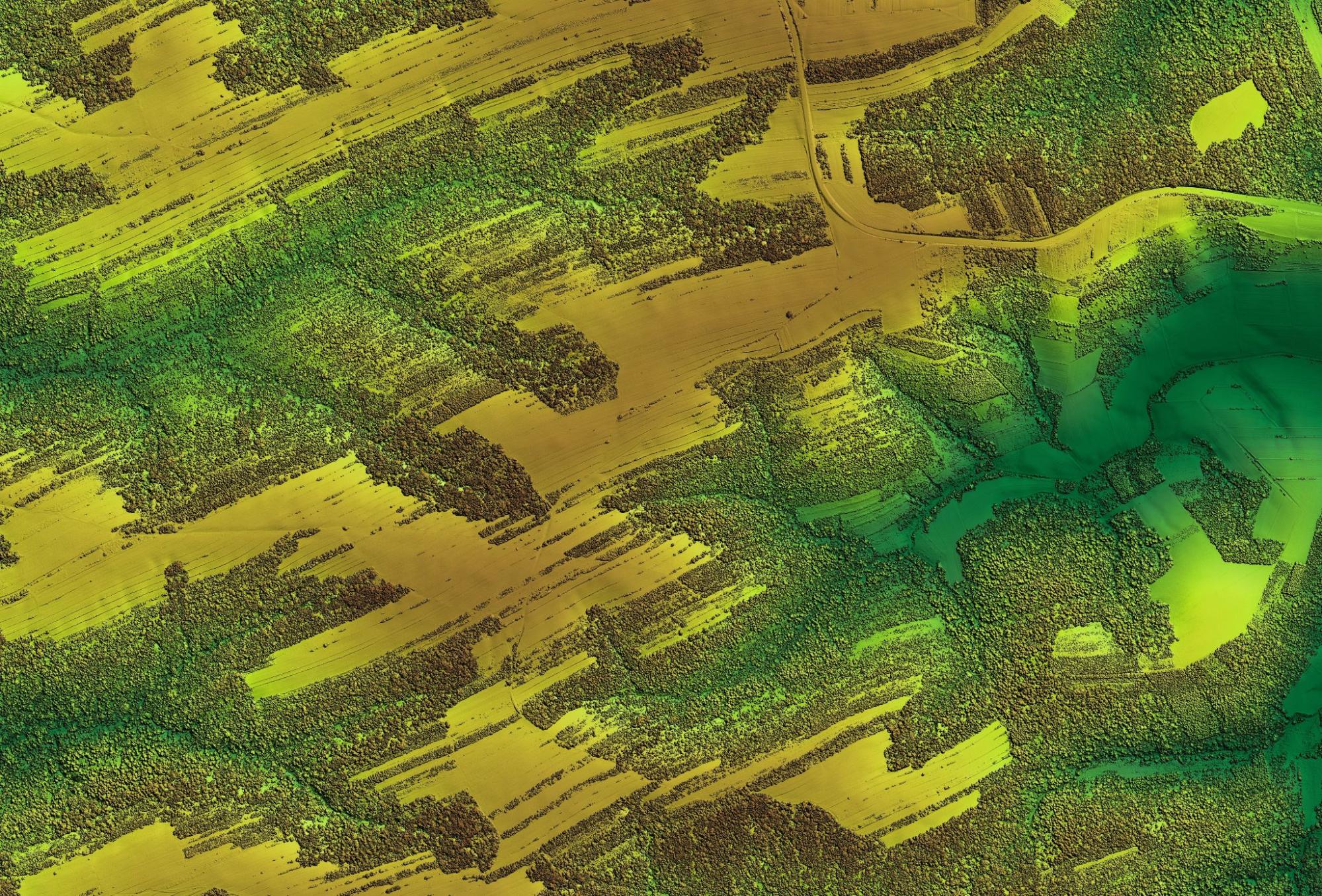
Forest Management and Biodiversity Studies
Seeing through obstacles like forest canopies is one thing, but Lidar is also supporting the study and management of these environments to protect and manage them in the face of a changing climate. Lidar can be used to build 3D representations of the forest for things like:
- Understanding the dynamics of the forest.
- Mapping out sustainable forestry practices.
- Assessing habitats for species survivability.
Plus, Lidar is so accurate that it can capture the dimensions of individual trees and the spaces around them. This provides vital data to help us assess carbon storage, wildlife habitat analysis, and ongoing biodiversity monitoring. This helps conservationists spot early warning signs of everything from invasive species, infestations, and diseases.
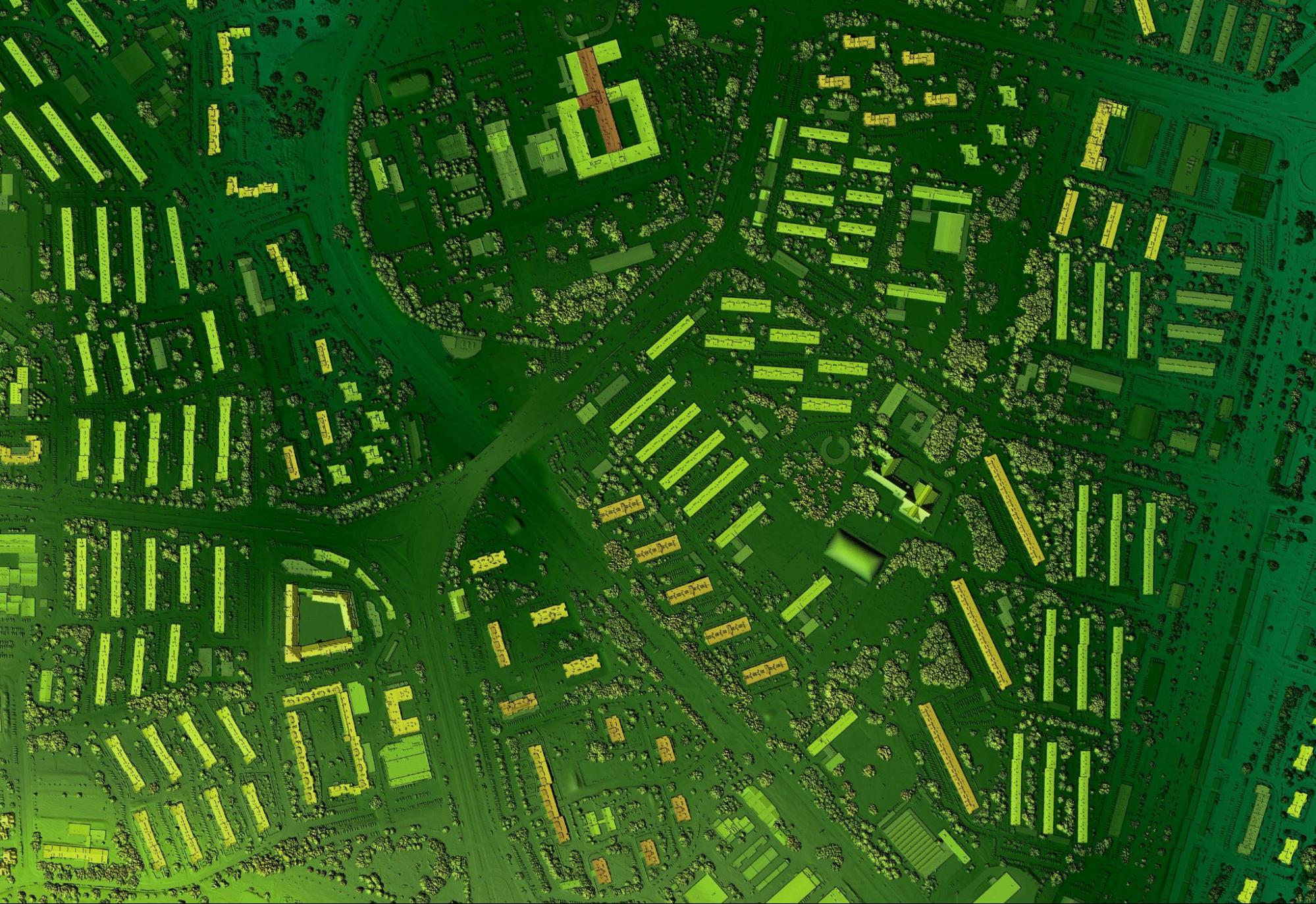
Urban Planning and Smart Cities
Airborne lidar surveys over many cities are conducted to create highly accurate 3D digital twins of urban environments by capturing detailed spatial information of buildings, infrastructure, and terrain. These digital replicas serve as powerful decision-making tools for urban planners and managers by enabling them to simulate changes, optimize resource allocation, and visualize potential impacts of development projects before physical implementation.
What does this mean in practice?
- Cities can implement more accurate flood modeling to design drainage systems.
- Lidar helps monitor the urban heat island effect, thus supporting strategies for mitigating it.
- Smarter planning by analyzing pedestrian movements to boost safety and improve transportation efficiency.
These are the uses that make cities of every size more pleasant to live in for everyone, while preparing them for significant challenges posed by climate change.
Agricultural Applications
Farming faces immense challenges in feeding the world’s population. With limited ability to expand, farmers are forced to make more from less. Lidar is already helping the next generation of farmers to streamline their processes and get more from their land.
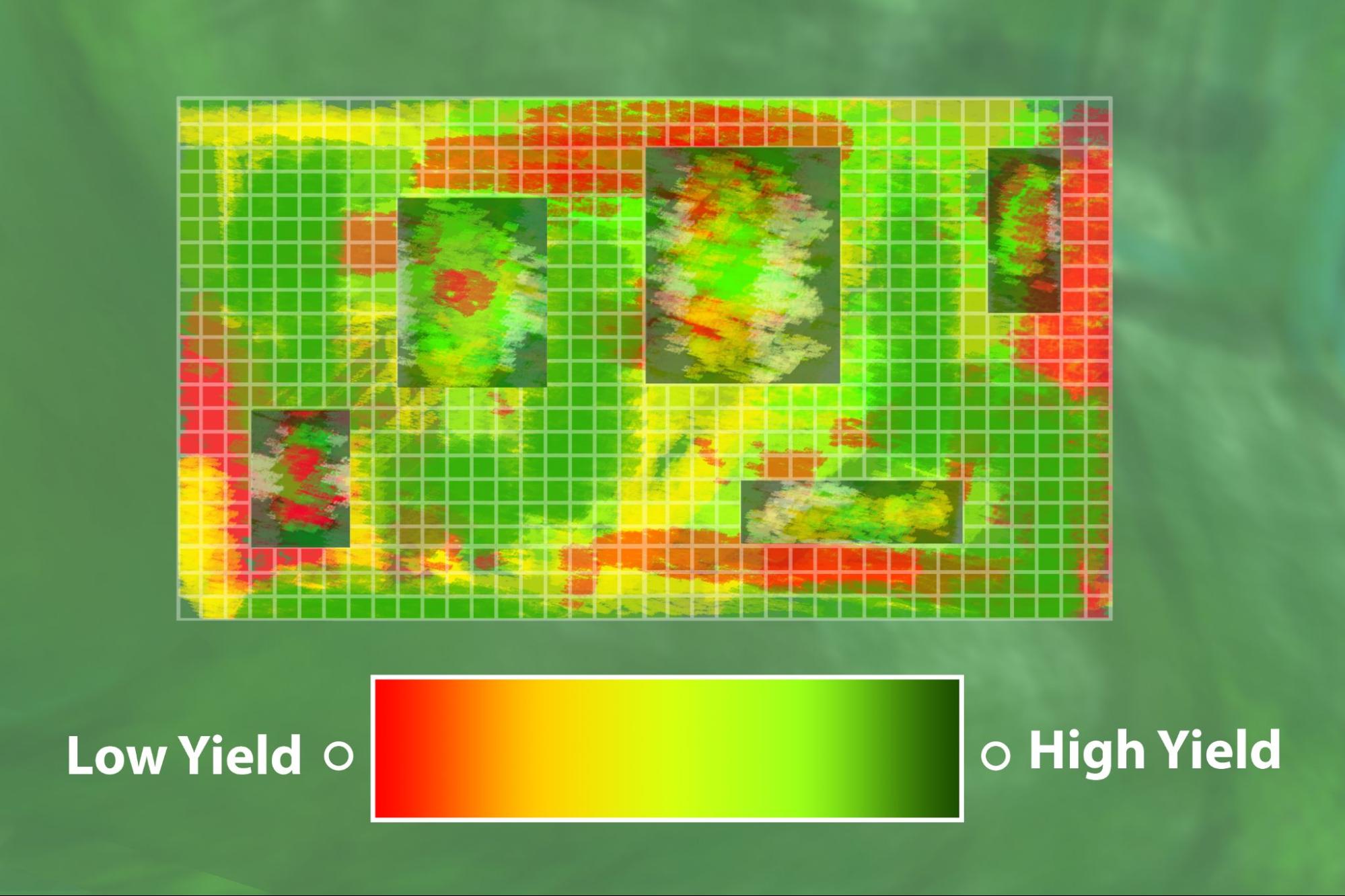
Not only can Lidar analyze entire tracts of land for microrelief mapping, land leveling, water management, and soil erosion mitigation, but it’s also capable of capturing individual crop structures in 3D.
For example, it can provide stage-by-stage analysis of crops throughout every stage to estimate biomass. Additionally, Lidar may be combined with other technologies, like multispectral analysis, to mark areas where water shortages could become an issue. Smarter irrigation management ultimately benefits both crop and livestock farmers.

Disaster Management and Emergency Response
One of Lidar’s best qualities is speed without compromising on accuracy. That’s why governments and disaster relief agencies can turn to Lidar-equipped drones, helicopters, and fixed-wing aircraft in times of emergency for information on infrastructure and terrain.
Real-time data is vital for post-disaster damage assessment, search and rescue, and predicting follow-up disasters like landslides. It’s why governments have already incorporated the technology into both early warning systems and risk mitigation.
Moreover, it’s ideal for complex environments, where other technologies might not be up to scratch. Lidar can penetrate everything from vegetation to fog, cloud, and smoke to help emergency teams pinpoint and direct victims.
It’s not an exaggeration that Lidar can mean the difference between life and death.

Snow Pack Measurement and Water Resource Management
Lidar technology can measure snow depth, density, and structure, which are vital metrics for predicting and mitigating avalanches. These measurements can then predict how much this adds up to in water, which can then be further extrapolated to measure issues like:
- Water availability
- Agricultural planning
- Water resource management
Additionally, these measurements can be logged over time to produce accurate modeling for avalanche risk, water availability, and climate change in the decades ahead.
Electrical Infrastructure
Power lines are essential to national infrastructure, but carrying energy across vast distances means carving through remote and isolated areas. Corridor mapping is a critical aspect of reliable electrical infrastructure, with one of the biggest threats being vegetation.
Overgrown vegetation can quickly encroach upon power lines, leading to outages and wildfires. Lidar supports power companies in building and maintaining these corridors by providing accurate data on vegetation encroachment along these corridors. The technology can produce high-resolution 3D mapping to proactively detect issues before they become risks.
Moreover, it’s not just an issue of negating risks but also upgrading these corridors to make them more resilient and incorporating new technologies over time. Lidar can be used to generate detailed topographic maps to support strategic operations, while eliminating the costs associated with sending out human teams to remote areas to perform routine checks and surveys.
Construction Site Efficiency
Construction teams spend much time manually obtaining measurements to ensure quality control, safety, and structural integrity. High-value construction projects usually result in stakeholders demanding these numbers as a measure of progress, but these functions require immense resources and are prone to human error.
Lidar overcomes these issues by capturing 3D scans of entire sites in a fraction of the time without the same error risks. Even relatively minor measurement errors can result in totally incorrect conclusions being drawn, but with Lidar, this becomes a thing of the past. Lidar can operate in real-time and draw vital data points, including:
- Grading
- Structural alignment
- Elevations
Building companies can then use this data to detect any potentially dangerous deviations from design specifications. Furthermore, this has the knock-on effect of mitigating the risks of costly reworks further down the line, which only delays the completion of construction projects.
Emerging Entertainment and Artistic Uses
Lidar isn’t just an industrial tool but also one that has made its way into the entertainment industry. Over the years, virtual reality experiences and interactive art installations have become an enormous part of the next-generation art movement.
Artists and their teams can use the technology to create virtual reality environments based on real-life locations, with precise recreations. Additionally, the gaming industry has done the same thing to create its own environments and improve realism for players.
Building virtual reality locations is one thing, but it can also be used for augmented reality. By mapping out venues ahead of time, live performances can incorporate ultra-realistic stages and real-time effects to take audience engagement and immersion to an even higher level than before.
For instance, the latest versions of the Apple iPhone and iPad Pro have integrated Lidar scanners to enable quick plane detection and the ability to place objects in augmented reality without scanning, opening up a new generation of augmented reality apps.
Future Directions and Challenges
Where is Lidar going, and what obstacles does it have to overcome? High costs and the sheer size of the equipment have constricted its use in the past, but miniaturization and more competition have brought the cost down.
Lidar is also being integrated with more and more emerging technologies. For example, machine learning models, computer vision, and AI algorithms are now used to process data more efficiently for tasks like feature extraction, data fusion, object recognition, and noise reduction. In environments where visual context is vital, such as in applications like autonomous vehicles, Lidar is improving both safety and effectiveness.
But, of course, these enhancements come with costs, including higher data processing costs and large-scale energy consumption.
Conclusion
Lidar is being used in a broader variety of applications than ever. The data that we acquire from using lidar for surveys is transforming how we view and interpret the physical world, making it more of an integral part of society than ever before.
Choosing the right product is essential. ClearSkies Geomatics is the largest global broker for pre-owned aerial survey equipment. We are deeply experienced with remote sensing technologies such as lidar, and we consult with our clients to determine the best lidar solutions for their applications. Contact us today to learn more!


Company
Aerial Survey Products
Aircraft Marketplace
Cookie Preferences
