Mastering Aerial Photogrammetry: A Comprehensive Guide
General


Have you ever wondered how surveyors turn thousands of aerial photos into incredibly detailed maps, 3D models, and even virtual worlds? If so, welcome—you’re in the right place. Today, we're diving into the world of aerial photogrammetry, a technique that's transformed how we survey, map, and understand our planet. Whether you’re a seasoned professional or just curious about the cutting-edge tools shaping industries, this guide is packed with everything you need to know.
Before we dive into the technical details, you might be wondering—why choose ClearSkies Geomatics? With years of industry experience, our team is deeply familiar with the demands and advancements of aerial surveying. While we do not conduct aerial surveys ourselves, we have supported countless clients across various sectors by equipping them with the latest and most reliable aerial survey equipment available for lease or purchase. Our commitment is to help you access the best technology for your unique project needs, ensuring you have the right tools for outstanding results. Let’s get started.
Understanding the Fundamentals: How Photogrammetry Works

To begin, it's helpful to clarify what photogrammetry entails. At its essence, photogrammetry is the science of obtaining precise measurements and creating accurate models from photographs, most often captured from aerial platforms such as drones or aircraft. While it may seem complex at first glance, photogrammetry is simply the process of transforming two-dimensional images into highly detailed, three-dimensional representations—providing professionals with valuable, actionable data for a wide range of applications.
The Photogrammetry Process, Simplified
Image Acquisition & Processing
First, high-resolution cameras—mounted on drones or airplanes—snap overlapping images while flying above your site. These aren’t random snapshots; they follow a carefully mapped flight path to make sure every inch is covered from multiple angles.

3D Model Creation
Once the flight is done, those photos are stitched together using specialized photogrammetry software. By comparing the same points from different pictures, the software calculates their position in 3D space.
Point Cloud Generation
The magic behind the scenes is what’s called a "point cloud"—millions of tiny dots that, together, form a super-precise 3D map of your subject area.
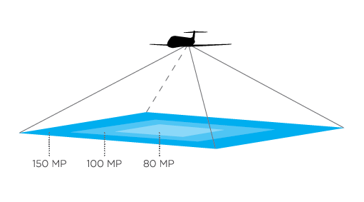
Data Accuracy & Precision
Here’s something people often ask: “How accurate is all this?” With high-quality aerial photogrammetry equipment, you can often achieve centimeter-level precision. But keep in mind, accuracy depends on everything from camera calibration to weather conditions.
We dive even deeper into how aerial cameras work in this helpful guide.
Essential Equipment: Cameras, Drones, and Software for Aerial Photogrammetry
Selecting the right equipment is fundamental to achieving successful results in aerial photogrammetry. Much like every recipe requires the proper ingredients, every photogrammetric project relies on specialized cameras, aircraft, and software to capture and process precise data. Utilizing survey-grade camera equipment not only streamlines your workflow but also ensures the accuracy and reliability essential for professional surveying and mapping outcomes.
Cameras

Medium Format Cameras
For photogrammetry and mapping missions, medium format cameras are the gold standard for aerial surveying. Brands like Phase One are industry favorites, known for delivering pin-sharp images with wide coverage.

Large Format Cameras
Large format cameras have the ability to capture expansive areas with exceptional detail and clarity, allowing for accurate mapping and 3D modeling of terrain and structures. Their wide coverage and superior image quality significantly enhance large-scale mapping projects, making them indispensable tools in modern geospatial data acquisition.

Multispectral and Hyperspectral Sensors and Cameras
Need to see below the surface or assess crop health? These specialized cameras and sensors capture wavelengths invisible to the naked eye.
Curious about what makes a great mapping camera? Check out our insider’s guide to Phase One aerial mapping cameras.
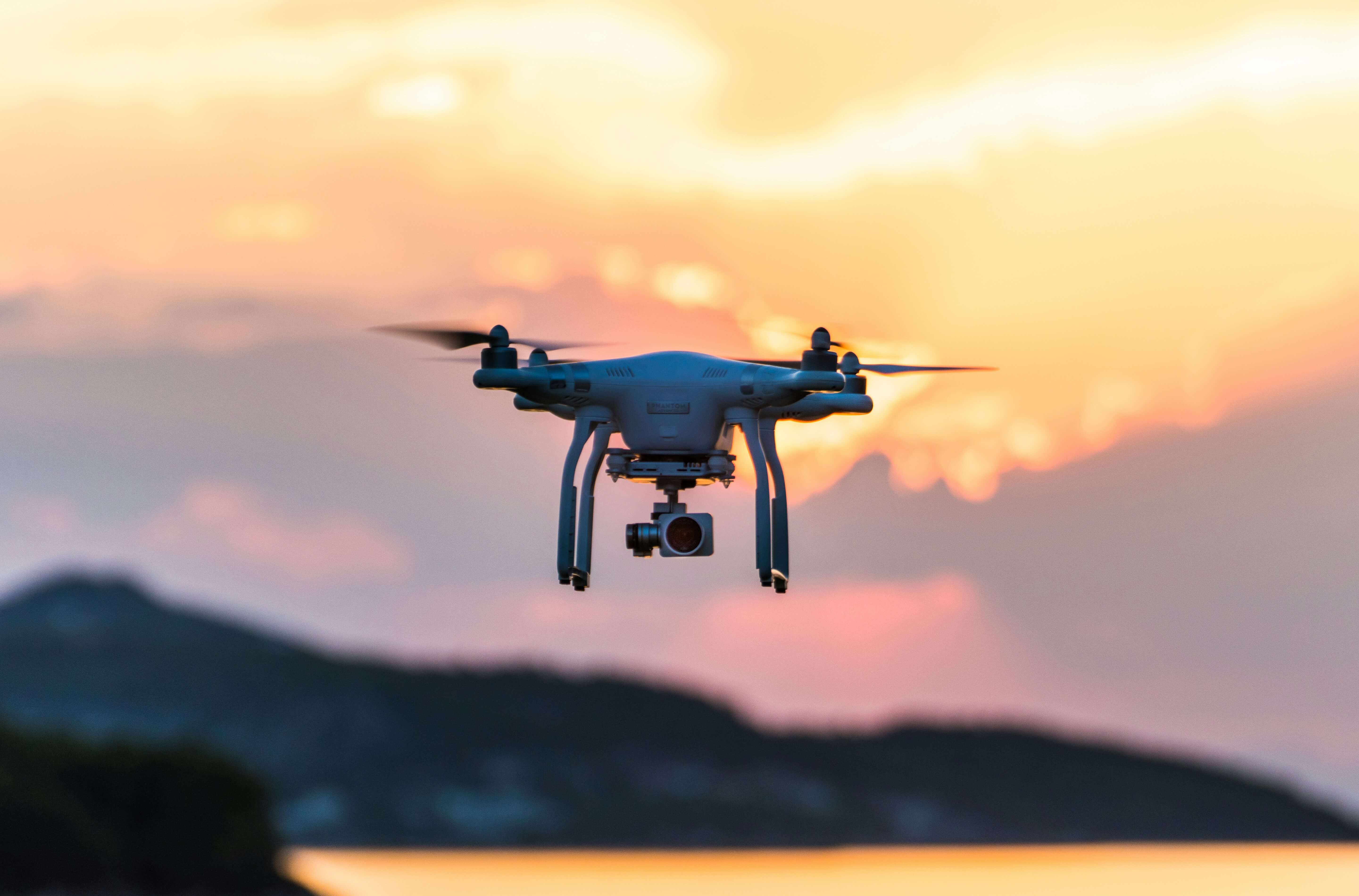
Drones
The introduction of drones has significantly enhanced both the accessibility and versatility of aerial photogrammetry. No longer limited to large-scale or highly specialized operations, organizations of all sizes can now capture high-resolution imagery and site data quickly and efficiently. However, selecting the right drone is essential to achieving reliable results. We recommend considering the following key features when evaluating drones for photogrammetry applications:
- Flight Stability: A reliable drone holds steady, rain or shine.
- Payload Options: Make sure it can carry your chosen camera.
- GPS Precision: The more accurate, the better your data.
- Drone Laws: Make sure you know the laws in your region for operating drones.
Software
No matter how advanced your camera, you need robust software to turn pictures into maps or models. Depending on the camera sensor you are using, you will likely use the brand’s software to do initial processing, and then take it into your favorite GIS post-processing software for refinement.
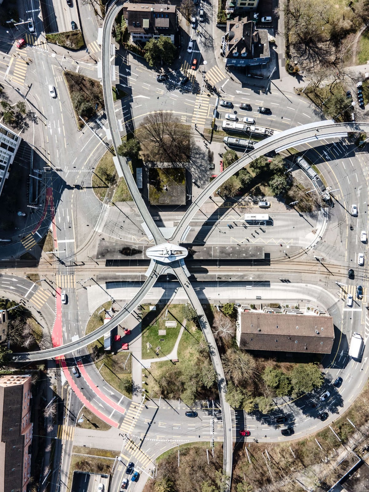
Real-World Applications: Utilizing Aerial Photogrammetry in Various Industries
While photogrammetry is often associated primarily with map-making and land surveying, its potential extends far beyond these traditional uses. Today, a wide variety of industries leverage aerial photogrammetry and geospatial technology to support decision-making, improve project outcomes, and drive innovation. From construction and infrastructure monitoring to agriculture, environmental management, urban management, disaster management and recovery, and cultural heritage preservation, the applications of this technology are as diverse as they are impactful.
Common Use Cases
Mapping & Surveying
The bread and butter. Accurate topographic maps, boundary surveys, and elevation models.

Infrastructure Monitoring
Dams, bridges, pipelines, powerlines—use aerial photogrammetry to keep tabs on these critical assets and spot issues before they become headaches.
Construction Progress Tracking
Project managers love how easy it is to compare “before and after” snapshots or track site development every week.
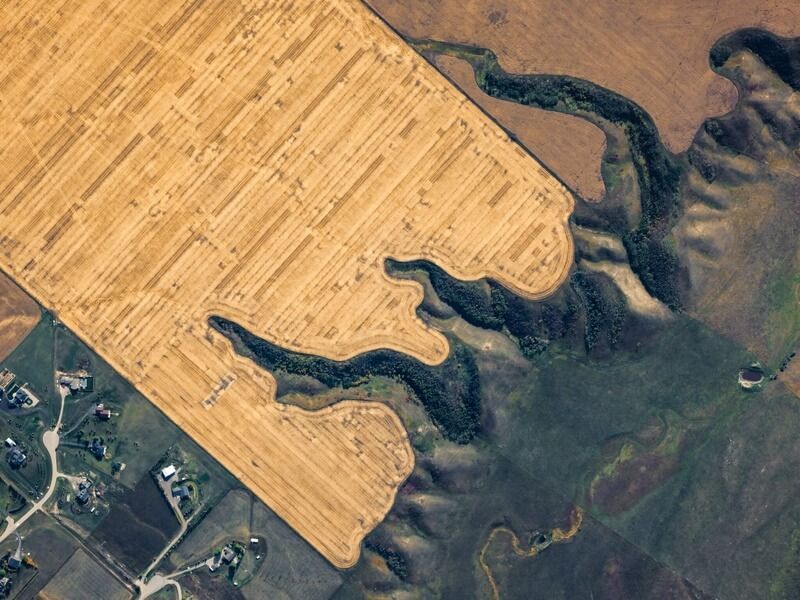
Agriculture & Forestry
Analyze crop health, plan irrigation, or monitor forest growth with multispectral aerial imagery.
Archaeology & Cultural Heritage
Think ruins and historical sites. Photogrammetry preserves fragile sites digitally—so future generations can enjoy and study them.
Elevate Your Aerial Surveying with Photogrammetry
At ClearSkies Geomatics, we believe that cutting-edge technology should empower our clients—not overwhelm them. Whether you are a seasoned aerial survey company looking to update your assets or expand your capabilities, or a new company just starting out, we’re here to help every step of the way.
Ready to upgrade your project? Explore our wide range of aerial survey equipment rentals—from state-of-the-art cameras to the latest high-efficiency lidar systems. Have questions or want to see photogrammetry in action? Looking to lease or buy aerial survey equipment? Contact us today and let’s map the future together.
ClearSkies Geomatics: Your trusted partner for aerial survey equipment to buy, rent, or sell.
If you enjoyed this guide or found it helpful, feel free to check out our News Section for more insights and tips about aerial surveying technology!


Company
Aerial Survey Products
Aircraft Marketplace
Cookie Preferences
