Insider's Guide to Phase One Aerial Mapping Cameras
General


.png)
We’ve been selling used Phase One products for years, but now we are thrilled to be able to offer new Phase One Aerial Mapping Cameras to our clients.
Each time we get an inquiry about a Phase One camera, we share a brochure with the features and technical specifications.
So for this blog article, we thought we would spend some time digging in to the iXM-RS150F/iXM-RS100F brochure, pulling out some of the technical terms and concepts, and giving our clients an “Insider’s” Guide to turn the marketing jargon into real-world application.
What is a Full Frame Aerial Mapping Camera?
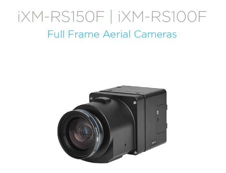
The first thing we see on the brochure is that the iXM-RS150F and iXM-100F are called “Full Frame Aerial Cameras.” What does this mean?
This full-frame camera uses a sensor size of 53.4 X 40mm. This larger sensor size allows for larger individual pixels, which can capture more light and detail. This enables them to offer better image quality, especially in terms of low-light performance and dynamic range. Full frame cameras also have no crop factor, so the image does not get cut off as it might with a smaller sensor.
What is a Metric Camera?
Phase One cameras are professional metric cameras specialized for photogrammetry and aerial surveying for mapping purposes. They are generally more rugged than commercial photography cameras so they can withstand varied temperature and humidity conditions at a range of altitudes.
Metric cameras are designed to capture images with known and precise knowledge of their external orientation, meaning the position and orientation of the camera in space during image acquisition. This information is crucial for accurately mapping the terrain or objects in the images.
Metric cameras are carefully calibrated to ensure that the internal parameters of the camera system are known. This calibration involves determining the focal length, lens distortion, and other intrinsic camera parameters.
To learn more, listen to this excellent webinar by Simactive featuring Don Cummins from Air Data Solutions and Kevin Graville from Phase One.
What is a Backside-Illuminated CMOS Sensor?
The iXM-RS150F has “An ultra-high resolution, backside illuminated CMOS sensor.” Let’s break this term down to understand it.
- CMOS Sensor: CMOS stands for Complementary Metal-Oxide-Semiconductor. CMOS sensors convert photos to electrons to create a digital image, and are known for their low power consumption as compared to older CCD technology.
- Backside-Illuminated (BSI): In a traditional CMOS sensor, the wiring and other circuitry partially block incoming light, reducing the sensor's efficiency. With BSI technology, light has a more direct path to the light-sensitive elements. This design allows more light to reach the pixels because there are fewer obstacles in the path of incoming light. This enables BSI sensors to be particularly effective in low-light conditions.
What is a Central Leaf Shutter?
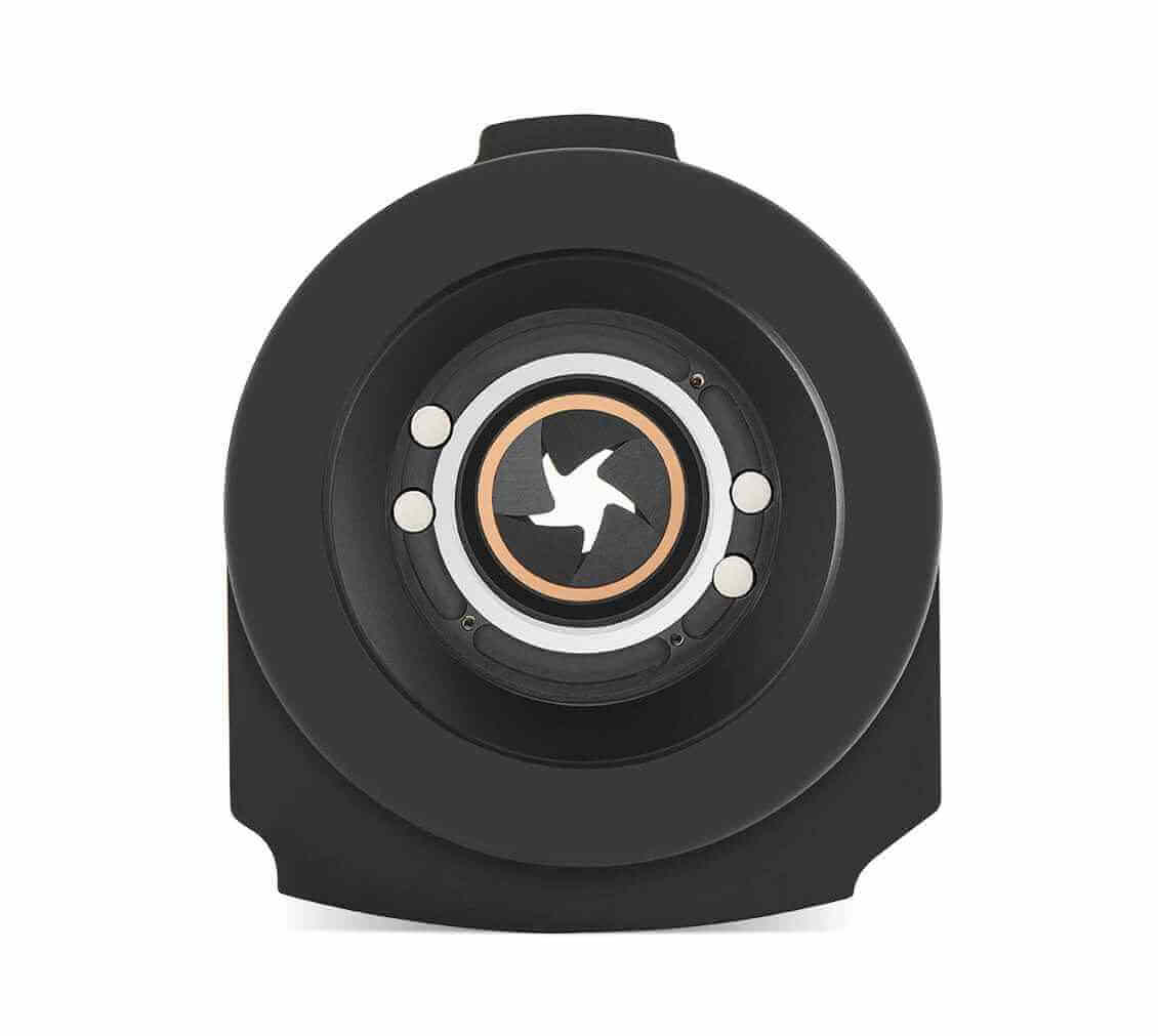
A leaf shutter is a type of shutter mechanism that consists of several overlapping metal blades in a circular arrangement which open and close to control the exposure time.
When the shutter button is pressed, the blades move to create an opening, allowing light to reach the image sensor. The exposure time is determined by how long the blades remain open.
Leaf shutters typically generate less camera shake because they open and close smoothly. The Rodenstock lenses used with the Phase One iXM-RS150F have an integrated leaf shutter which allows for high capture speed in a variety of flight conditions.
How can the RGB, 4-Band and NIR cameras be used?
The Phase One cameras can be used as standalone RGB cameras or Achromatic NIR (near infrared) cameras, or they may be used in combination to create a four-band camera solution which pairs an RGB camera with an NIR camera for multi-spectral imagery projects.
The 4-band camera solution is ideal for photogrammetry projects that need to analyze vegetation, such as crop analysis for growth optimization and vegetation health. It is also useful to surveying environmental contamination or urban green site monitoring
What is so special about the XQD storage card?
Phase One cameras come with a super fast XQD storage card. What is that?
XQD (Extended Quad Data Rate) is a type of high-performance memory card format designed for use in professional-grade cameras and other high-end imaging devices. Key advantages include:
- High Speeds: XQD cards provide for extremely fast data transfer rates. This is critical for photogrammetrists who work with large file sizes.
- Durability: XQD cards are designed to be robust and durable, which helps protect the card from physical damage, moisture, and temperature variations. This durability is crucial for surveyors working at altitude.
- Reliability: XQD cards are known for their reliability and stability during data read and write operations. This is crucial for aerial survey projects to avoid costly data loss or corruption.
What does Actuation Capacity mean?
The Phase One iXM-RS150F boasts a 500k actuation capacity. The term "actuation capacity" refers to the estimated number of shutter actuations or clicks a camera's shutter mechanism can endure throughout its lifespan before it may potentially require maintenance or replacement.
The shutter mechanism on the iXM-RS150F is designed and rated to withstand approximately 500,000 shutter actuations.
It’s important to note that the actuation capacity is an estimate, and the actual lifespan can vary based on usage patterns, environmental conditions, and other factors.
Why does the Phase One iXM-RS150 claim a wider coverage area?
Phase One data shows that the 150mp sensor in the camera enables it to increase coverage by 89% as compared to the 80mp camera, and 26% as compared to the 100mp camera while maintaining high Ground Sample Distance (GSD).
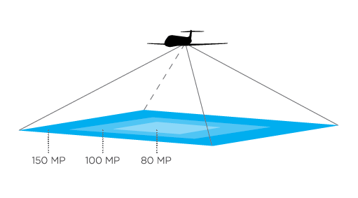
Ground Sample Distance (GSD) refers to the distance on the ground represented by one pixel in an image. In other words, GSD quantifies the size of the area on the Earth's surface that each pixel in an image corresponds to.
GSD is a crucial factor in mission planning for aerial surveys. Depending on the application, users may choose a specific GSD to achieve the desired level of detail in the resulting imagery.
Because of the wider area and width of acquisition while maintaining high ground sample distance (GSD), aerial survey flights can increase efficiency by flying fewer lines.
Conclusion
It’s important to go beyond the marketing language when considering the capabilities of an aerial mapping camera. We will always help our clients understand the nuances and benefits of the features in the cameras we sell. Don’t hesitate to ask us any questions you have as you review product brochures or technical specifications for aerial mapping cameras or other equipment. You can find all of our aerial survey equipment at AERIALSURVEY.com.


Company
Aerial Survey Products
Aircraft Marketplace
Cookie Preferences
