HydroRANGER
Availability
Description
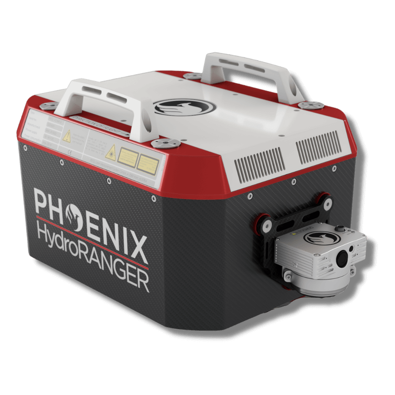
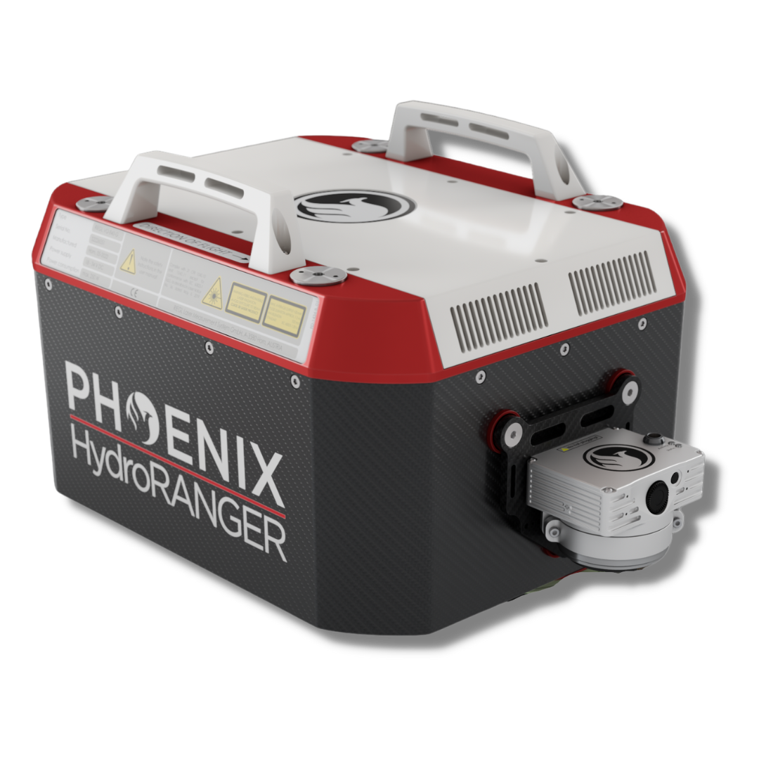
PHOENIX HydroRANGER.
Riegl Inside! This complete system incorporates the Riegl 840-G laser scanner.
The HydroRANGER is an evolution of mapping technology. This Airborne Topo-Bathymetric (ATB) system provides dual-purpose topographic and bathymetric measurements for full scene mapping of shoreline systems. Utilizing a visible green spectrum laser with an elliptical scan pattern and measurement rates up to 200 kHz, the HydroRANGER provides a combination of high spatial resolution and spatial accuracy.
Capable of reaching beyond 2 Secchi depths, this is the ideal solution for mapping land-water interface environments along rivers, reservoirs, oceans and more!
Featuring the new Phoenix LiDAR AIR NavBox
The NEW RANGER LITE includes Phoenix LiDAR’s new AIR NavBox. The newest generation, ultra-lightweight rover will help meet the rigorous demands of various industries and applications by greatly increasing flexibility in key areas:
- Reducing weight to allow longer flight-times on lighter UAVs.
- Much improved data throughput to accommodate multiple sensors producing more data as pixel count and pulse repetition frequencies increase.
The new Phoenix LiDAR AIR NavBox offers the most industry-altering capabilities in a tiny box not much bigger than a standard-size computer mouse.
- Dimensions: 60 x 125 x 50 mm\
- Weight 450g
- Control via button, 4g, wifi or ethernet
Gallery

Request a Quote
Get in touch directly with our sales team
Join +15K active subscribers
Stay in the loop! No spam. Ever.


Company
Aerial Survey Products
Aircraft Marketplace
Cookie Preferences
