
RANGER FLEX DUAL MOBILE SYSTEM RFM2-UAV22
Availability
Description
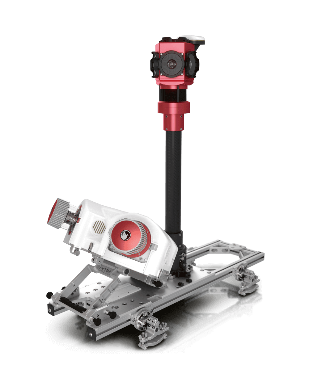
PHOENIX RANGER FLEX Dual Mobile System RFM2-UAV22
Riegl Inside! This complete system incorporates 2x Riegl VUX-1UAV-22 - a powerful, fully-integrated mobile mapping system.
The mobile accessory kit for the RFM2-UAV22 scanner transforms the functionalities of the RANGER-UAV22 FLEX single scanner into a high-performing dual scanner mobile system.
The arrangement of the dual scanners is strategically devised to yield significant time savings on-site while ensuring comprehensive point coverage, achieving an impressive speed of up to 2.4 million measurements per second.
Both the RANGER-UAV22 FLEX and the dual scanner mobile accessory are crafted with flexibility at the forefront. The standalone RANGER-UAV22 FLEX payload serves as the central control unit within the dual scanner mobile accessory. When detached, it becomes a versatile tool for backpack and UAV applications, introducing an additional layer of adaptability to your toolkit.
This Mobile Mapper features:
- Adjustable 30 and 45 degrees tilt angle of dual scanner platform gives higher mounting flexibility for various cars and trucks.
- Removable dual scanner platform
- Survey-Grade (cm-level) accuracy with 250m+ laser range and outstanding intensity calibration on high altitude and high speed missions
- Penetrates vegetation to produce accurate results
- Phoenix Software Suite compatible; plus NovAtel & Terrasolid options also available (fee may apply)
- High accuracy due to precision Gyro IMU
- Live/Remote Data Feed: View and analyze data in real time or transmit live data to remote viewers via 4G connection
- Optional and removable 360° LadyBug 5+ or LadyBug 6 Camera with integrated SLAM Assist Hesai and XT32 scanner and GNSS Antenna
- Optional DMI sensor
- Integrated UHF radio modem
- High-Precision IMU upgrade available
Featuring the Phoenix LiDAR FlexPack
The RANGER UAV Flex system includes Phoenix LiDAR’s FlexPack, increasing flexibility in key areas:
- Reduced external wiring allows for a more robust integration.
- Improved data throughput to accommodate multiple sensors producing more data as pixel count and pulse repetition frequencies increase.
Gallery

Request a Quote
Get in touch directly with our sales team
Join +15K active subscribers
Stay in the loop! No spam. Ever.


Company
Aerial Survey Products
Aircraft Marketplace
Cookie Preferences
