Demystifying Lidar Jargon for Renters: Key Terms You Need to Know for Wide-Area Aerial Surveys
General


Introduction: Navigating the Lidar Landscape
Starting a new wide-area aerial survey project can feel a bit like being handed the keys to a spaceship—exciting, but…where do you even start? If someone just tossed around terms like "point density" or "PPK" in your last project meeting and you smiled while frantically scribbling notes, don’t worry—you’re not alone.
Here at ClearSkies Geomatics, we’ve spent over 30 years helping people just like you get comfortable with aerial survey equipment. We truly enjoy demystifying remote sensing technology, so you can rent top-quality gear without getting lost in translation. After all, we think Lidar system rental should be empowering, not intimidating.
In this article, we’re going to tackle THE essential Lidar terminology, answer some of the questions you might have been afraid to ask, and set you up to select exactly the right system for your next wide-area survey. Trust me, you don’t need a PhD to understand this stuff.
Let’s dive in!
Core Lidar Data Products: What You Get
To begin, you might be wondering: what exactly will you receive from an airborne sensor system when your survey project is finished? Modern aerial Lidar systems can enable you to deliver an impressive range of data products, each serving a unique purpose in your workflow. Understanding these outputs is the first step toward making the most of your equipment rental. Let’s explore some of the essential deliverables you’re likely to encounter:
LAS File
What is it?
An LAS file is the go-to standard for storing Lidar point cloud data in a compact binary format. It's essentially a digital package containing all the critical information captured by a Lidar sensor, including the precise x, y, and z coordinates of each laser return, along with attributes like intensity and return number.
Why do you care?
For anyone involved in an aerial survey project, understanding LAS files is crucial because they are the foundational deliverable – the raw material, if you will – from which all other valuable insights and products are derived. In essence, the LAS file is the direct representation of the Point cloud itself, which is the next key data product we'll explore.
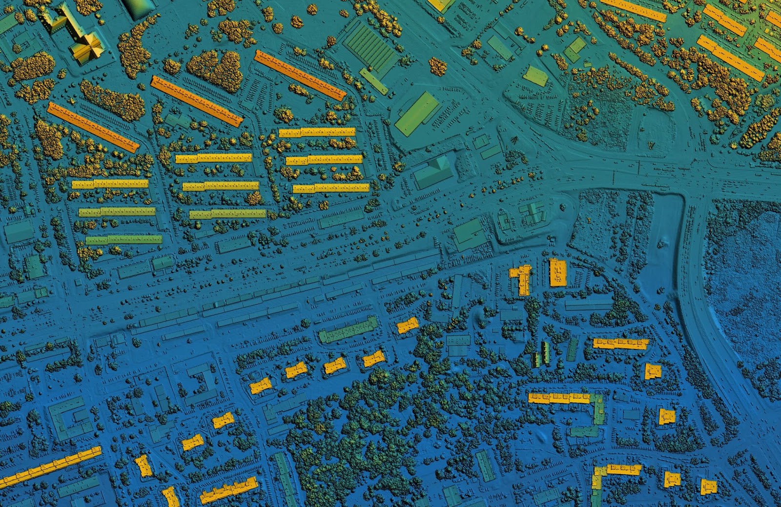
Point Cloud
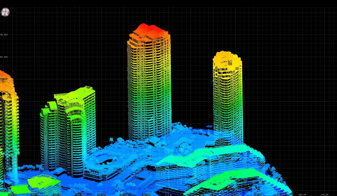
What is it?
Point clouds can be thought of as the ultimate 3D connect-the-dots. When an airborne Lidar system completes a flight, millions—sometimes billions—of points, each with X, Y, and Z coordinates are created. This data represents everything the laser scanner “saw,” from the tops of trees to the bottom of shallow depressions.
Why do you care?
This is the most fundamental output of any airborne laser scanner. When renting an airborne Lidar system, you’ll obtain the raw data via a hard drive with the point clouds required to create a calibrated LAS file. Knowing what’s in them makes it way less intimidating to discuss your needs—whether that’s higher density, certain formats, or post-processing.
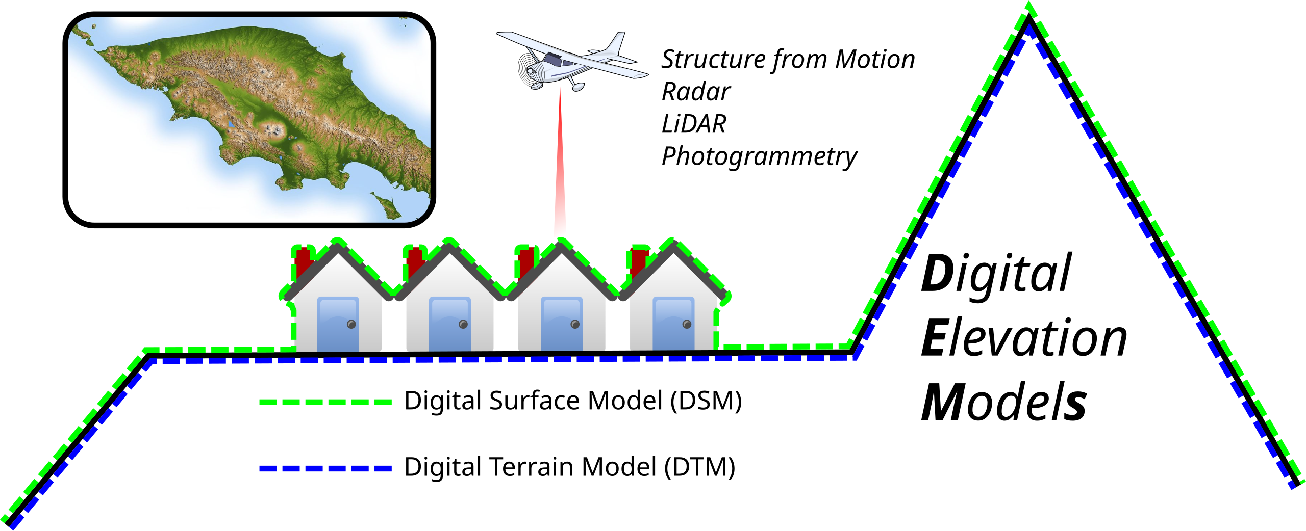
Digital Elevation Model (DEM)
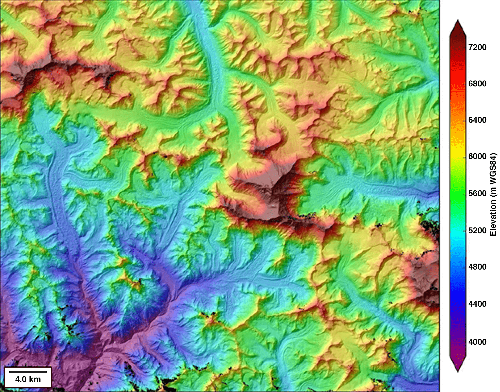
What is it?
DEM is a simplified, “bare earth” representation of the surveyed area. By digitally removing trees, buildings, and vehicles, the resulting model displays only the underlying landform.
Why do you care?
DEMs are invaluable for floodplain mapping, hydrology modeling, or any project where you need to understand how water will move or accumulate. This is a common request in many aerial Lidar scanning applications.
Digital Terrain Model (DTM)
What is it?
DTM is often used interchangeably with DEM, but sometimes includes additional natural features—like riverbeds, ridgelines, or embankments. It’s the "true" surface, minus the built environment.
Why do you care?
This information is essential for civil engineers and environmental scientists involved in site preparation, earthworks, and accurately assessing the land’s true contours beneath surface features. If there’s uncertainty about whether a DEM or DTM is most appropriate for a particular project, it’s a common question. These terms are often confused, and our team regularly assists clients in determining the best fit for their specific requirements.
Digital Surface Model (DSM)
What is it?
While DEM shows the land, DSM is the “top of everything” model—it includes buildings, trees, vehicles, even piles of gravel.
Why do you care?
For urban planning, forestry, or inspecting infrastructure from the air, DSMs help you see how the landscape is changing—not just where the ground lies, but what sits on it.
Key Performance & Operational Terms: How Lidar Systems Work

When you’re shopping for a Lidar system rental, or even considering buying your first Lidar, when reading specs about your airborne Lidar sensor, you’ll run into all sorts of metrics. Here’s what matters:
Pulse Repetition Rate (PRR) / Scan Speed
What is it?
PRR is simply how many laser pulses the Lidar system fires per second. Scan speed relates to how fast the scanner head rotates or sweeps.
Why do you care?
More pulses per second generally mean more data points and faster coverage. If you’re facing a tight deadline or need very detailed mapping, a higher PRR can be a lifesaver. For example, utility clients often struggle surveying dense vegetation using airborne laser scanners. Moving to a high pulse repetition rate (PRR) airborne Lidar systems allows for the acquisition of far denser data in just half the time.
Points Per Square Meter (PPM) / Point Density
What is it?
PPM refers to the number of individual data points—or “dots”—captured within a given unit of area. This metric is crucial, as higher point density allows for the detection of finer details and more accurate representation of surface features in the survey.
Why do you care?
Mapping small features like cables, narrow ridges, or pipelines, requires more data points. If you’re just mapping broad landscapes, a lower density might suffice. Don’t hesitate to discuss with us what makes sense for your project’s intended use.
Field of View (FOV)
What is it?
FOV refers to the total angle or width that the Lidar scanner is able to capture during each pass, spanning side to side across the survey area. A wider FOV means the system covers a larger swath of ground in a single flight line, increasing operational efficiency and potentially reducing the overall number of flight lines and flight time.
Why do you care?
Wider FOV means more ground covered per flight line, which is great for cutting project time and costs—especially over larger areas. One forestry project cut its planned flight hours by a quarter just by opting for a system with a broader FOV.
Georeferencing, RTK/PPK, IMU/GNSS
What is it?
- Georeferencing is tying your data to real-world coordinates (so it matches up with maps and GPS).
- RTK (Real-Time Kinematic) and PPK (Post-Processed Kinematic) are advanced positioning methods—think GPS with cm-level accuracy.
- IMU (Inertial Measurement Unit) captures the sensor’s orientation.
- GNSS (Global Navigation Satellite System) is the umbrella for all global satellite positioning (GPS, GLONASS, Galileo, etc.).
Why do you care?
These ensure your aerial Lidar scanning outputs are in the right place, with the right precision. For surveying property boundaries or infrastructure, bad georeferencing can mean serious headaches down the road. The right gear, like the Riegl VQ-1560 II-S for rent, will include these robust options.
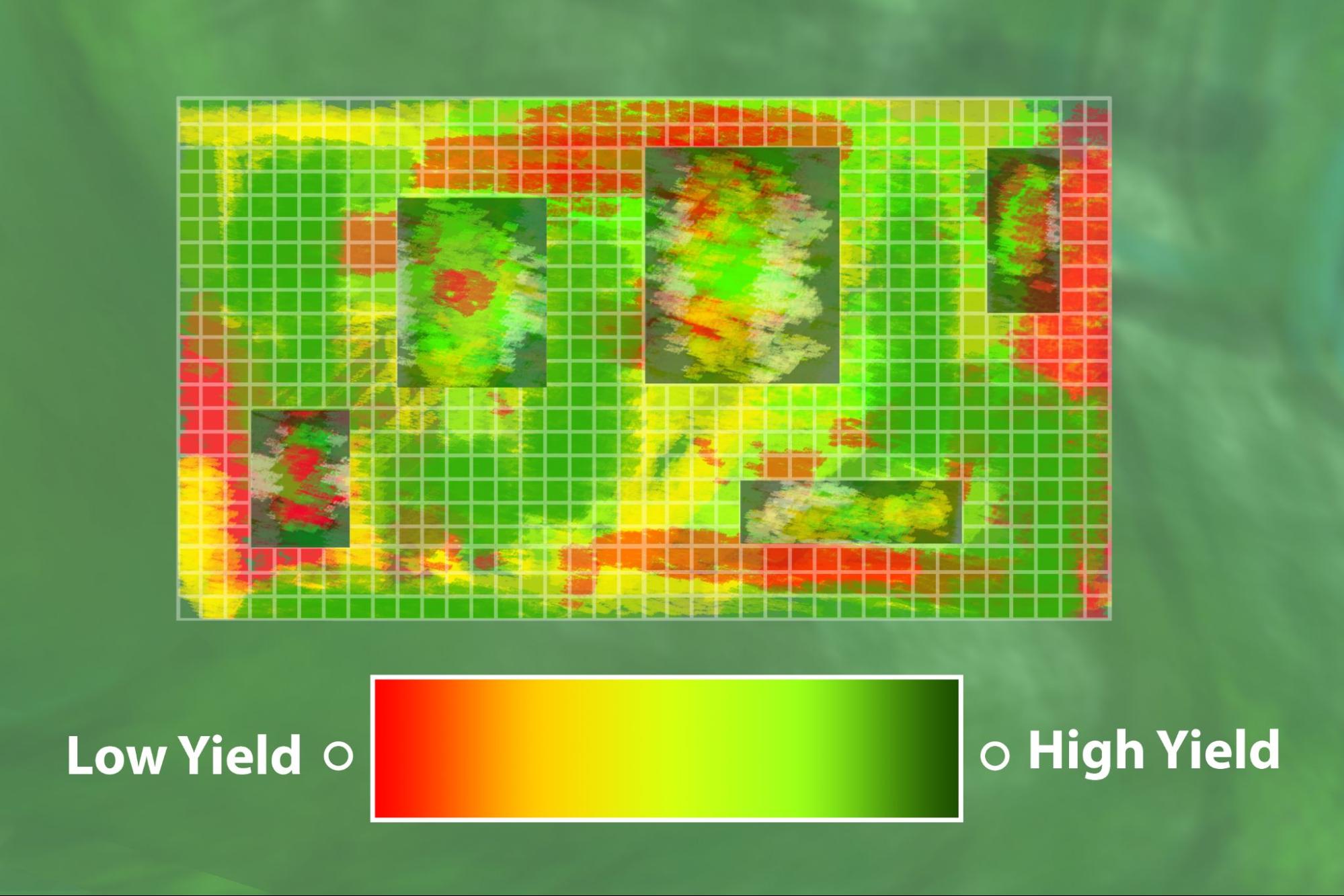
Post-Processing & Data Quality: Refining Your Data
%2520(1).png)
Acquiring large volumes of high-quality, aerial data is a critical milestone, but it represents only part of a successful Lidar project. The subsequent post-processing and management of this data are equally significant, as proper handling ensures the information is accurate, actionable, and aligned with project objectives. Attention to these follow-up stages is essential for delivering reliable results and ensuring overall project success.
Classification
What is it?
The Classification stage involves the use of specialized software, often supplemented by expert human input, to systematically assign labels or classifications to each point within the Lidar dataset.
Why do you care?
Imagine trying to design a road, but your ground model includes treetops. Not ideal! Properly classified data makes it so much easier to use your point clouds for whatever application you need. Rentals of advanced systems like the Riegl VQ-1560 II-S for rent mean you’re equipped for accurate, efficient classification.
Feature Extraction
What is it?
This is turning clouds of points into actual objects—say, picking out powerlines, roads, or a stand of specific trees from the jumble.
Why do you care?
This is where your Lidar data turns into useful information for design, engineering, or presentation. Not all projects need advanced feature extraction, but if yours does, it’s good to clarify this up front. We’re always happy to talk through post-processing options when you’re considering an aerial sensor system rental.
Accuracy vs. Precision
What is it?
- Accuracy: How close your measurements are to reality
- Precision: How consistent or repeatable your measurements are
Why do you care?
Both matter, but for different reasons. If you care about location—does my map actually line up with the real world?—you want accuracy. If you want to detect change over time or need detailed modeling, you need precision. The right rental equipment means you don’t have to choose one at the expense of the other.
Putting it in Context
How do all of these terms and measurements fit together in context?
When clients ask for survey accuracy down to 10 cm, 5 cm, or even 2 cm, they’re essentially setting the bar for how closely the lidar data must match real-world ground truth. Achieving that level of accuracy isn’t just about the power of the lidar sensor itself—it’s a careful balance of system specifications and flight planning. Pulse Repetition Rate (PRR) dictates how many laser shots are fired per second, which influences how dense the point cloud will be. Points Per Square Meter (PPM) reflects how many of those returns actually land within each unit of area, which is critical for resolving fine details like narrow ridges, wires, or ditches. Flight altitude adds another layer: the higher you fly, the wider your coverage but the lower the point density, and—by extension—the harder it becomes to hit a tight accuracy target. In practice, getting down to 2 cm accuracy could require a combination of a high-PRR sensor, a planned flight profile that minimizes altitude to boost point density, and robust GNSS/IMU support to keep every point properly georeferenced. This is why system selection isn’t just checking a single spec, but aligning sensor capabilities and flight parameters with the accuracy requirement of the specific project.
Conclusion: Your Confident Lidar Rental Journey with ClearSkies Geomatics
.png)
Let us take a moment to reflect. Gaining a solid understanding of the essential Lidar terminology discussed—such as point clouds, DEMs, and PRR—plays a pivotal role in maximizing the value of aerial survey equipment rentals. Improved fluency in this technical language enables clearer communication, facilitates more effective comparison of rental options, and empowers better decision-making throughout the course of a project.
Feeling overwhelmed at the start is normal, but acquired knowledge not only builds confidence, it empowers you to communicate your goals and requirements clearly. Whether you’re new to Lidar technology or just brushing up, you now have an edge when it’s time to select your aerial sensor system rental.
Ready to put this new know-how to work? Head over to ClearSkies Geomatics’ “Rent Equipment” page to browse our collection of aerial survey equipment for rent. We pride ourselves on honest, ethical service, technical expertise, and a dedication to making your renting experience seamless from start to finish.
Have questions? Not sure which spec is best for your corner of the world? Don’t hesitate to contact us. We’re here to help you navigate the high-tech world of remote sensing and ensure you end up with the right aerial sensor for your project.
Happy surveying!


Company
Aerial Survey Products
Aircraft Marketplace
Cookie Preferences
