What Are the Best GIS Software Tools Used By Aerial Surveyors?
General


Introduction

Most of our time is spent talking to clients about the front end of the geospatial process… doing the aerial surveys to acquire the data that then goes into making maps.
In this article, we’d like to spend some time talking about the back end of the process - post-processing and how some of the best GIS software tools are used to turn the acquired survey data into meaningful information for decision makers.
What is GIS software?
GIS (Geographic Information System) software is a powerful tool for integrating, managing, analyzing,and displaying geospatial data in a variety of formats and applications.
GIS software allows users to create, store, manipulate, query, analyze, and visualize geospatial data.
We’re talking about geographic data that have a location component, such as coordinates, addresses, boundaries, or features.
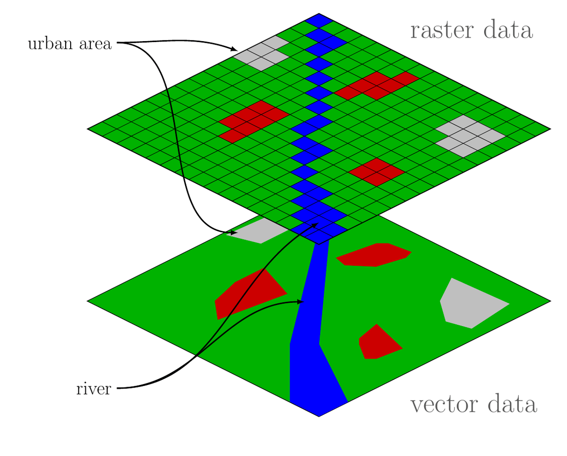
GIS software tools can handle different types of geographic data, such as raster data (images, elevation models, satellite imagery), vector data (points, lines, polygons, networks), and attribute data (tabular data, metadata, statistics).
Why are GIS software tools useful for aerial surveyors?
GIS software tools are useful for aerial surveyors because they can help them to:
- Manage and organize large amounts of aerial data: GIS software tools can store aerial data in a centralized database, which can be accessed, updated, and shared by multiple users and applications. The best GIS software can also organize aerial data into layers, categories, or themes, which can be easily turned on or off, or overlaid with other data sources.
- Process and enhance aerial data: GIS software tools can process aerial data, such as georeferencing, rectifying, mosaicking, or clipping images, or generating orthophotos, digital elevation models, or 3D models. GIS software tools can also enhance aerial data, such as applying filters, corrections, or classifications, or extracting features, objects, or patterns.
- Analyze and interpret aerial data: GIS software tools can analyze aerial data, such as measuring distances, areas, volumes, or heights, or calculating slopes, aspects, or contours. GIS software tools can also interpret aerial data, such as identifying land use, land cover, vegetation, soil, water, or urban features, or detecting changes, anomalies, or trends.
- Communicate and present aerial data: GIS software tools can communicate and present aerial data, such as creating maps, reports, or dashboards, or exporting data to other formats, such as PDF, JPEG, or KML. GIS software tools can also display aerial data in interactive and immersive ways, such as using web maps, mobile apps, or virtual reality.
What functions can the best GIS software tools perform?
- Data conversion: GIS software tools can convert geographic data from one format to another, such as from CAD to GIS, from shapefile to geodatabase, or from raster to vector.
- Data editing: GIS software tools can edit geographic data, such as adding, deleting, moving, or modifying features, attributes, or projections.
- Data analysis: GIS software tools can analyze geographic data, such as performing spatial queries, measurements, calculations, statistics, modeling, or simulations.
- Data visualization: GIS software tools can visualize geographic data, such as creating maps, charts, graphs, or 3D scenes.
What criteria should be used to compare the best GIS software tools with each other?
When comparing GIS tools to determine the best one for your specific needs, it's essential to consider various criteria. The importance of each criterion can vary depending on your particular use case, but here are some key factors to consider when evaluating GIS tools:
1. Data Compatibility:
- Does the GIS tool support the data formats and sources you plan to work with (e.g., shapefiles, GeoJSON, web services, satellite imagery, etc.)?
- Can it integrate with other databases and data management systems?
2. Functionality and Features:
- What core GIS functionalities does the tool provide (e.g., mapping, spatial analysis, geocoding, routing, 3D visualization)?
- Does it offer specialized tools for your specific industry or application (e.g., environmental, urban planning, transportation)?
- Are there add-ons or plugins available for extended functionality?
3. User Interface and Ease of Use:
- Is the user interface intuitive and user-friendly?
- Does the tool offer comprehensive documentation and user support to help users get started and troubleshoot issues?
4. Performance and Scalability:
- How well does the GIS tool perform with large datasets or complex analyses?
- Can it handle the scalability demands of your projects, both in terms of data volume and user load?
5. Spatial Analysis and Geoprocessing:
- Does the tool provide advanced geospatial analysis capabilities, such as spatial statistics, network analysis, and proximity analysis?
- Can you create custom geoprocessing workflows?
6. Customization and Extensibility:
- Is the GIS tool open-source, allowing for code-level customization?
- Can you develop custom applications or scripts to extend its functionality to meet your specific requirements?
7. Data Visualization:
- What options does the tool offer for creating maps and visualizing data?
- Are there tools for cartography, symbolization, and label placement?
8. Data Editing and Management:
- Does the tool support data editing and versioning?
- Can you perform data validation and data quality checks within the GIS?
9. Integration and Interoperability:
- Can the GIS tool integrate with other software and systems, such as databases, cloud platforms, and web services?
- Does it support industry standards for data exchange and interoperability (e.g., OGC standards)?
10. Cost and Licensing:
- What are the licensing costs and pricing models associated with the GIS tool?
- Are there free or open-source alternatives that meet your needs?
11. Community and Support:
- Is there an active user community and support resources (forums, documentation, tutorials)?
- Is professional support available for critical issues?
12. Security and Data Privacy:
- Does the GIS tool provide features for data security and access control?
- Is it compliant with relevant data privacy regulations?
13. Mobile and Web Capabilities:
- Can you deploy your GIS applications to mobile devices or web platforms?
- Does it offer responsive design for mobile and web users?
14. Vendor Reputation and Longevity:
- What is the reputation of the GIS tool's vendor or development community?
- Is the tool likely to be maintained and updated in the long term?
By carefully evaluating these criteria and prioritizing the ones that are most relevant to your specific GIS project, you can make an informed decision when selecting the best GIS software tool for your needs.
Keep in mind that different GIS tools may excel in different areas, so it's important to align your choice with your specific project requirements and budget constraints.
What are some examples of GIS software tools for aerial surveying?

There are dozens of GIS software tools available for aerial surveying, each with different features, functions, and prices. Some of the most popular and widely used GIS software tools for aerial surveying are:
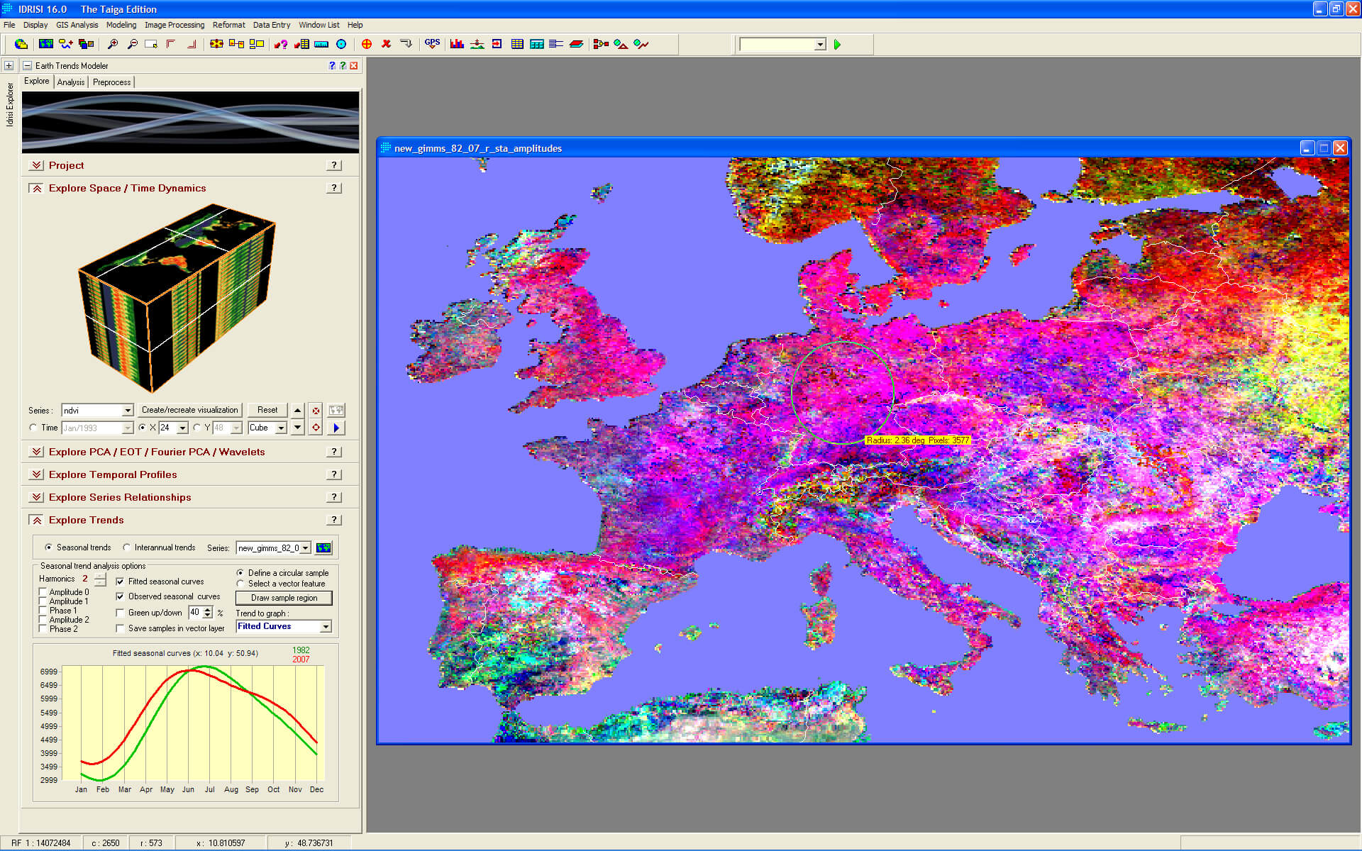
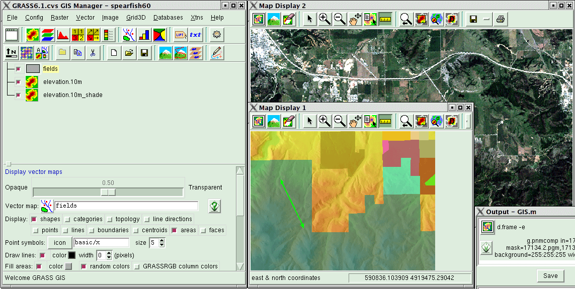
- ArcGIS: ArcGIS Reality Studio is a cloud-based service that can create accurate and realistic 3D models from aerial imagery. ArcGIS Pro is a desktop application that can perform advanced spatial analysis and visualization of aerial data. Site Scan for ArcGIS is a drone flight planning and data processing software that can capture and upload aerial data to the cloud. ArcGIS Drone2Map is a desktop application that can create orthomosaics, digital elevation models, and 3D models from drone imagery.
- Pix4D: Pix4D is a leading photogrammetry software company that offers various products and solutions for aerial surveying, such as Pix4Dsurvey, Pix4Dcloud, Pix4Dmapper, and Pix4Dcapture. Pix4Dsurvey is a desktop application that can extract relevant information from photogrammetry to develop models and engineering-ready CAD files. Pix4Dcloud is a cloud-based service that can process, analyze, and share aerial data online. Pix4Dmapper is a desktop application that can create orthomosaics, digital elevation models, and 3D models from aerial imagery. Pix4Dcapture is a mobile app that can plan and control drone flights for aerial data capture.
- Agisoft Metashape: Agisoft Metashape is a professional photogrammetry software that can process aerial imagery and generate high-quality spatial data, such as orthophotos, digital elevation models, and 3D models. Agisoft Metashape can also perform various tasks, such as georeferencing, accuracy assessment, feature extraction, classification, and measurement.
- Global Mapper: Global Mapper is a versatile and affordable GIS software that can handle a wide range of aerial data formats and applications. Global Mapper can perform various functions, such as data conversion, editing, analysis, and visualization. Global Mapper can also process and display aerial imagery, digital elevation models, and 3D models.
How to select the best GIS software tool for your needs?
There is no single best GIS software tool for aerial surveying, as different tools may suit different needs, preferences, and budgets. However, some general tips for selecting the best GIS software tool for your needs are:
- Define your objectives and requirements: Before choosing a GIS software tool, you should have a clear idea of what you want to achieve and what you need from the tool, such as the type, quality, and quantity of aerial data, the level of accuracy and detail, the speed and ease of use, the functionality and compatibility, and the cost and support.
- Compare and evaluate different options: After defining your objectives and requirements, you should compare and evaluate different GIS software tools that meet your criteria, such as by reading reviews, watching demos, or requesting trials. You should also consider the pros and cons of each tool, such as the features, functions, performance, reliability, and user-friendliness.
- Test and validate the results: After selecting a GIS software tool, you should test and validate the results that it produces, such as by checking the accuracy, completeness, and consistency of the aerial data, or by comparing the results with other sources or methods. You should also seek feedback and suggestions from other users or experts, or from the tool’s developers or providers.
Conclusion
GIS software tools are essential for aerial surveying, as they can help aerial surveyors to manage, process, analyze, and communicate aerial data in various formats and applications. The best GIS software tools can also enhance the quality, efficiency, and effectiveness of aerial surveying, as they can provide accurate, detailed, and realistic depictions of the earth’s surface and features. However, GIS software tools are not all the same, and aerial surveyors should select the best tool for their needs, based on their objectives, requirements, and preferences.
While we don’t sell any GIS tools on our website, you can find new and used aerial survey gear used to acquire the raw data that feeds into all of the best GIS tools on the market.


Company
Aerial Survey Products
Aircraft Marketplace
Cookie Preferences
