Navigating the Skies with Precision: How Flight Management Systems Revolutionize Aerial Surveys
General


Introduction
Most of the time when we talk about aerial survey technology, we nerd out about the sensors. But it’s not all about cameras and lidar. A successful aerial survey must include a reliable flight management system.
In this article, let’s pivot and take a comprehensive look at the pivotal role of Flight Management Systems in aerial survey acquisition work. We’ll start with the fundamentals of FMS and then delve into navigation, autopilot features, and sensor management.
What is an Aerial Survey Flight Management System?
An FMS performs three key functions for aerial survey work:
- Flight planning
- Navigation and Autopilot
- Sensor control
In simplest terms, the FMS helps to create and execute a flight plan for the pilot to follow, and it triggers the sensors based upon predefined criteria.

Historically, aerial surveys were manual endeavors that required immense skill and effort. Pilots had to rely on rudimentary navigation tools, maps, and their own instincts to conduct surveys.
Not long ago, surveyors used paper maps and cameras with viewfinders like the one shown in this image of a Leica (Wild) RCD 30 camera system. The viewfinder was used for navigation and camera control. We asked some of our network contacts on LinkedIn how they handled flight management before today’s advanced Flight Management Systems were available.
“I remember planning with a compass, ruler and printed topographical maps with my grandfather circling with red color the major visual reference! (80s)”
-Félix Audirac, a 4th generation CEO of Cartodata
“I am probably one of the last to learn how to do things ‘the old fashioned way’. Since almost everything was captured with 6" film cameras back in the 1990's, we had a cache of USGS Quad Maps. We also had numerous Mylar templates depicting photo sizes at various flight scales. For smaller projects we simply traced the flight lines and models on quad maps on a light table. For ginormous plans of particularly difficult areas (massive changes in terrain in short distances and along flight lines) we moved furniture out of the conference room and spent a few days on our hands and knees tracing on scotched taped together Quad Maps on the floor.”
-Edward Kunz, Senior Project Manager at Kucera International
As technology advanced, the need for more precise and efficient survey methods increased, leading to the development of the FMS, a sophisticated avionics system that automates a wide range of in-flight tasks (and less time on the floor taping maps together).
Flight Planning

A flight management system simplifies the complex task of flight planning by calculating the optimal flight path based on the specific survey objectives. It takes into account factors such as the survey area's size, the type of data to be collected, and any environmental considerations.
An FMS’s flight planner tool can help operators estimate lidar swath and point density based on terrain and speed.
Navigation and Autopilot
One of the core challenges in aerial surveys is navigating the aircraft with precision over often vast and challenging landscapes.
Accurate navigation is essential for ensuring that the survey area is covered completely and that the data collected is relevant and useful.
The flight management system plays a crucial role in meeting this challenge, as it integrates with advanced navigation systems, such as a GPS and an Inertial Navigation Systems (INS), to calculate and maintain optimal flight paths.
GPS provides real-time positioning data, allowing the FMS to constantly update the aircraft's position and make course corrections as necessary.
This integration ensures that the survey aircraft stays precisely on track, even in challenging conditions or over remote areas.

Maintaining the stability of an aircraft during surveys is essential for data accuracy and the safety of the crew.
An FMS supports maintaining the aircraft's attitude, altitude, and speed.
Maintaining a consistent altitude ensures that survey instruments such as lidar and/or cameras collect data from a precise height above the ground.
When the flight management system manages speed, data is collected at the right pace, ensuring uniform coverage of the survey area.
Finally, by automating various flight control tasks, the FMS reduces the workload on pilots, allowing them to focus on monitoring the survey instruments and ensuring the safety of the aircraft.
Sensor Control
A key function of an FMS is to trigger a camera at a fixed time interval, fixed distance interval, or GPS position. It can also trigger a lidar to turn on and off at the start and end of each flight line.
Often multiple cameras or camera plus lidar installations are simultaneously used in aerial surveys. The FMS enables these multiple sensors to acquire data as an integrated system for efficient data collection.
Leading Flight Management Systems
Our industry is fortunate to have several excellent FMS solutions available for both manned and unmanned surveys. Not all Flight Management Systems work with all sensors so it’s a good idea to talk with the manufacturers (or ask us) about which sensors their FMS support. Some FMS options include:
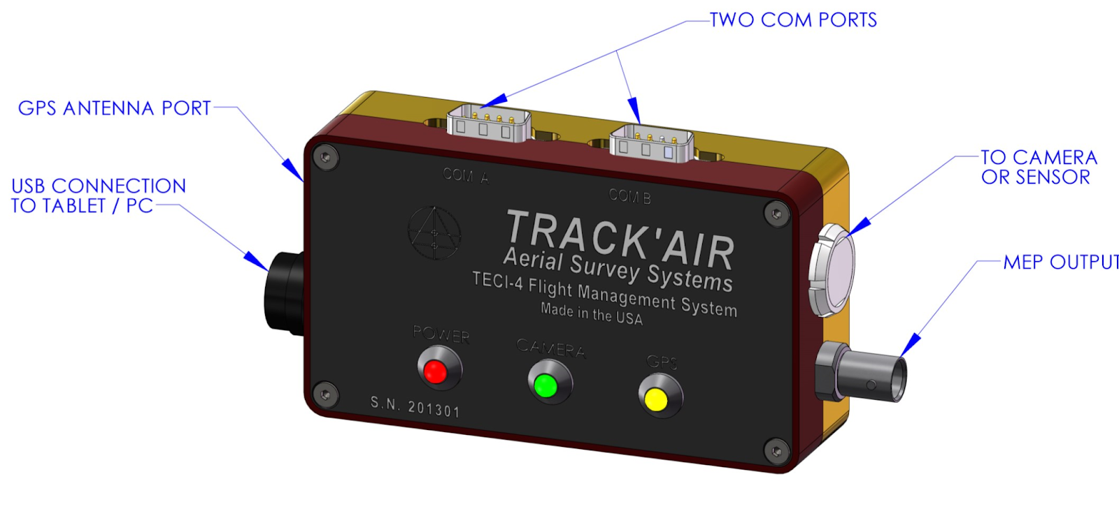
Lead’Air’s FMS includes the X-Track planning and reporting software as well as the snapSHOT32 control module for the in-aircraft acquisition process. Several OEMs, including the Applanix POSTrack and Vexcel UltraNav, have developed FMS products utilizing the Track’Air FMS as the foundation of their sensor control development.
TOPOFLIGHT is another popular flight management system for flight planning, navigation, and in-flight sensor handling.
The CCNS by IGI is a guidance, positioning and sensor management system for aerial survey missions. It can trigger all common digital & analog aerial camera systems, aerial thermal camera systems, as well as LiDAR, SAR and hyperspectral systems.
Spatial Explorer is a solution from Phoenix Lidar Systems that supports mission guidance for pilots and sensor operators. The system configures the sensor and stores profiles to ensure the correct settings during each acquisition, provides real-time point cloud and detailed navigation feedback for data quality control in the field, and live sensor control during acquisition.
Conclusion
In conclusion, Flight Management Systems provide the precision, automation, and efficiency needed for accurate data collection while improving safety for survey crews. We offer pre-owned flight management systems as well as new Lead’Air FMS solutions.


Company
Aerial Survey Products
Aircraft Marketplace
Cookie Preferences
