
C-Astral
Availability
Description
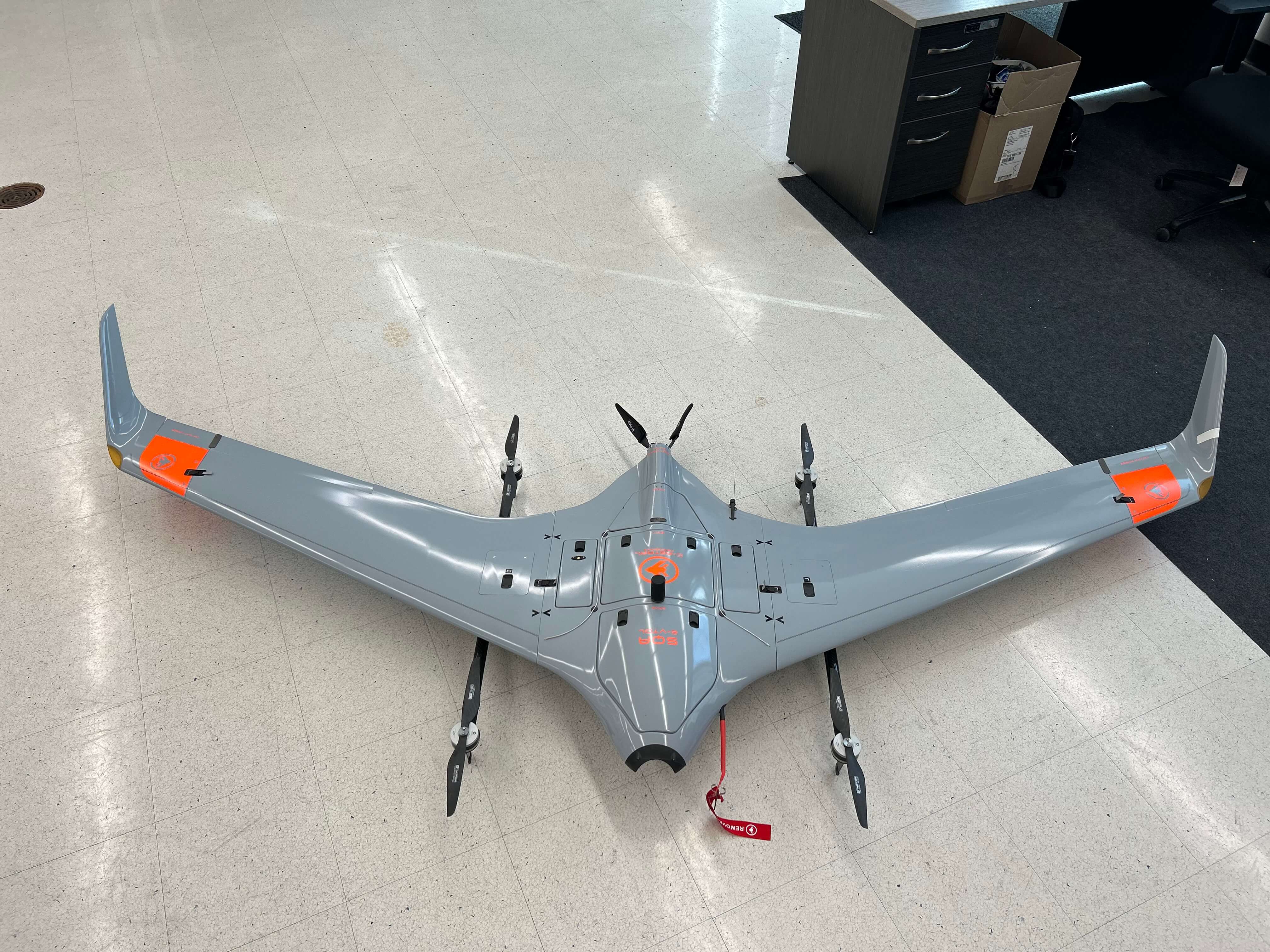
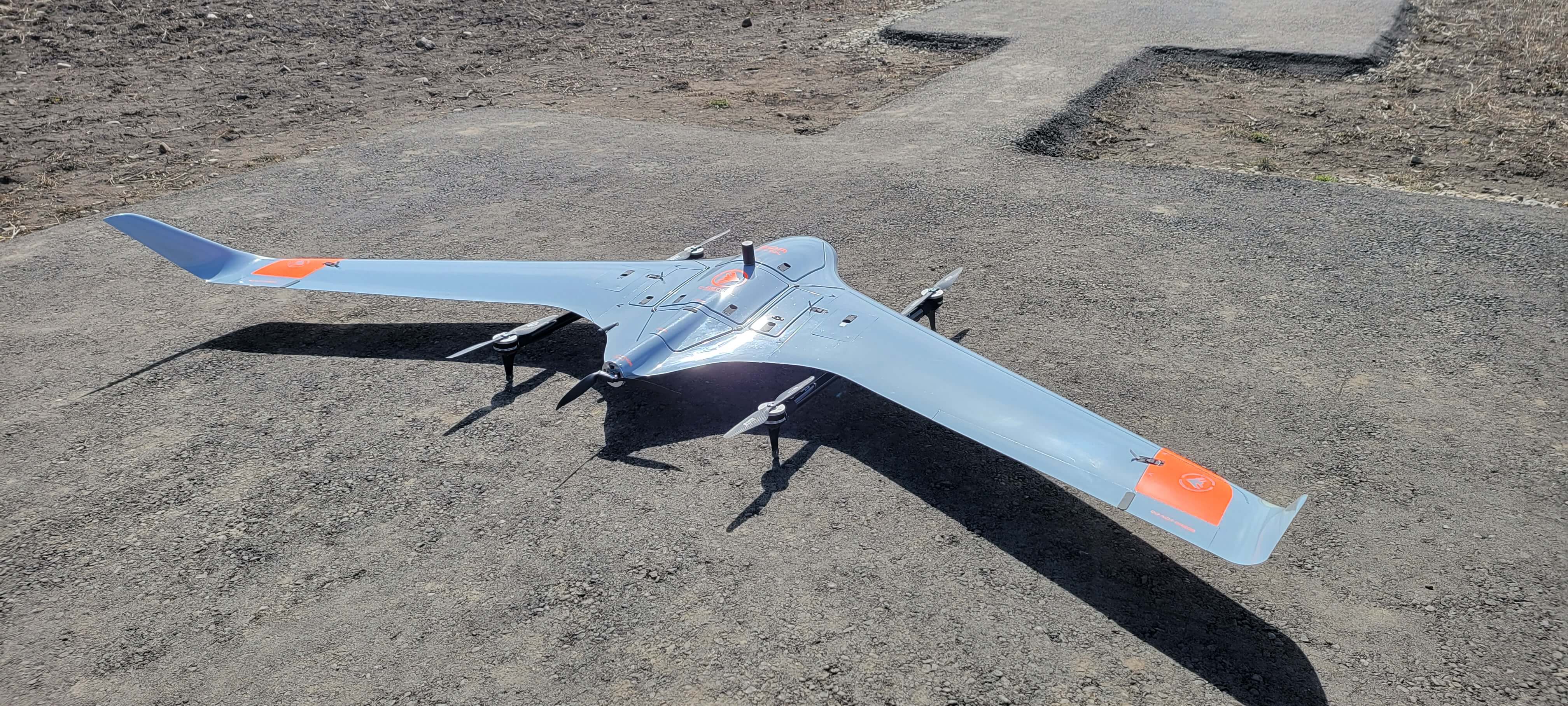
2023 C-Astral SQA VTOL UAS
- Total Flight Hours as of Jan 2026: 8 Hours
- Total Flight Cycles as of Jan 2026: 17 Flights
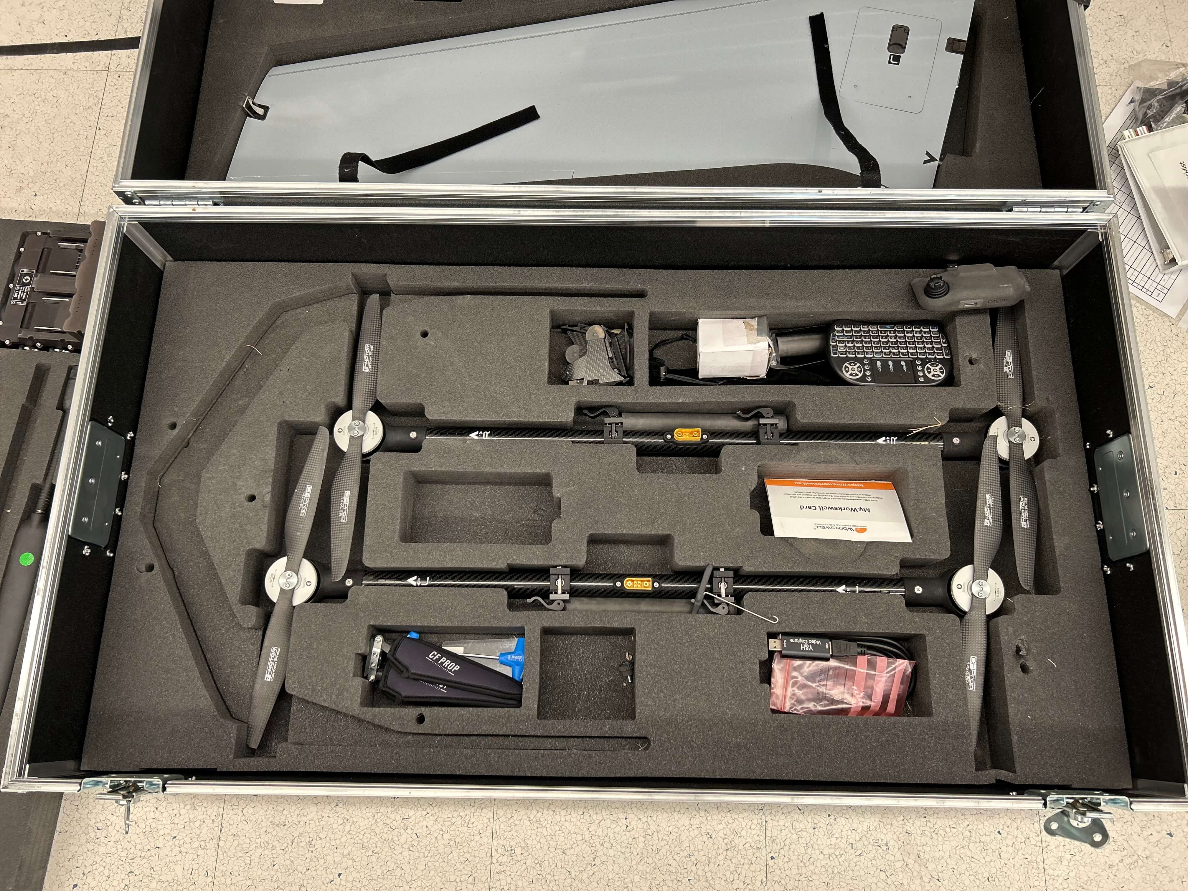
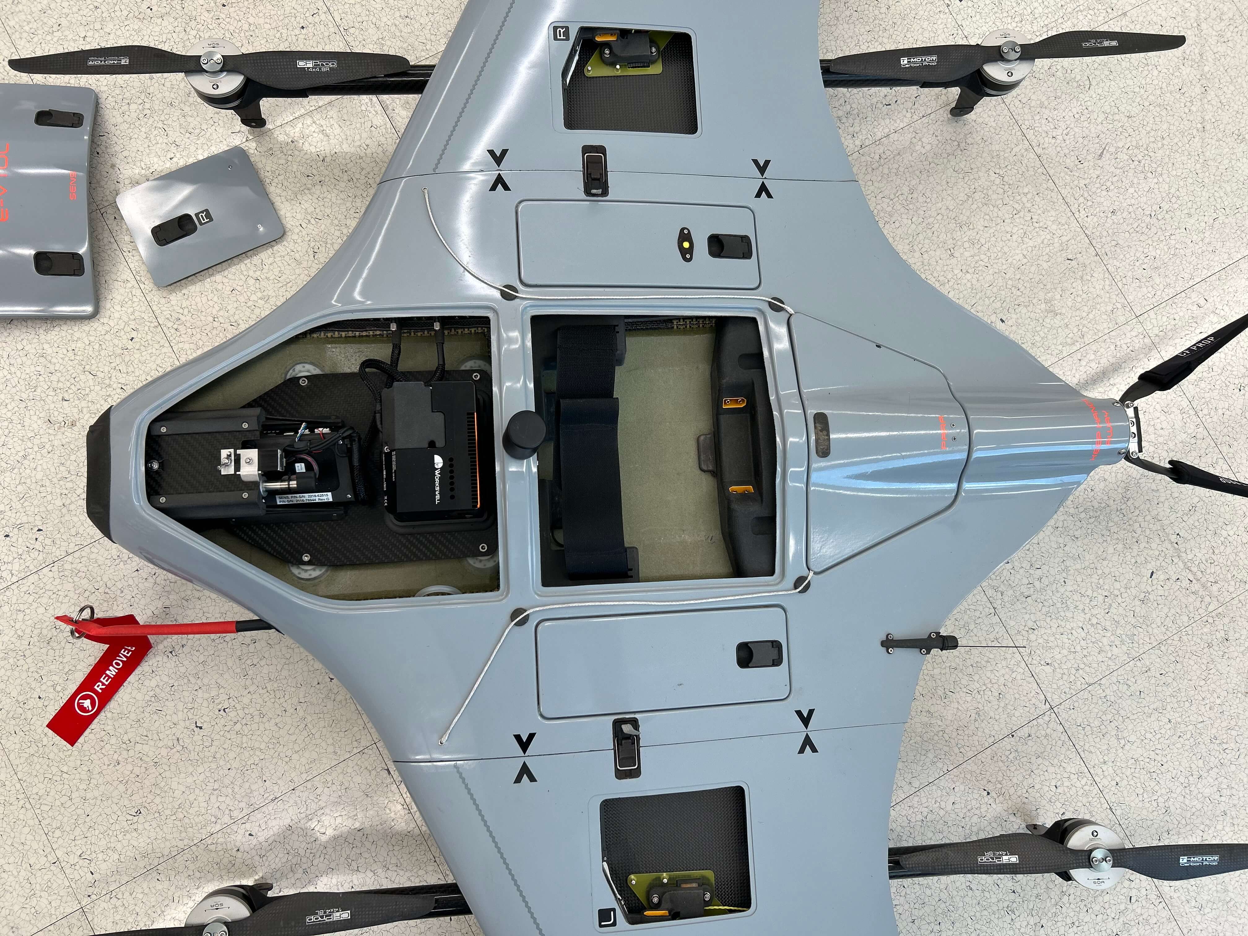
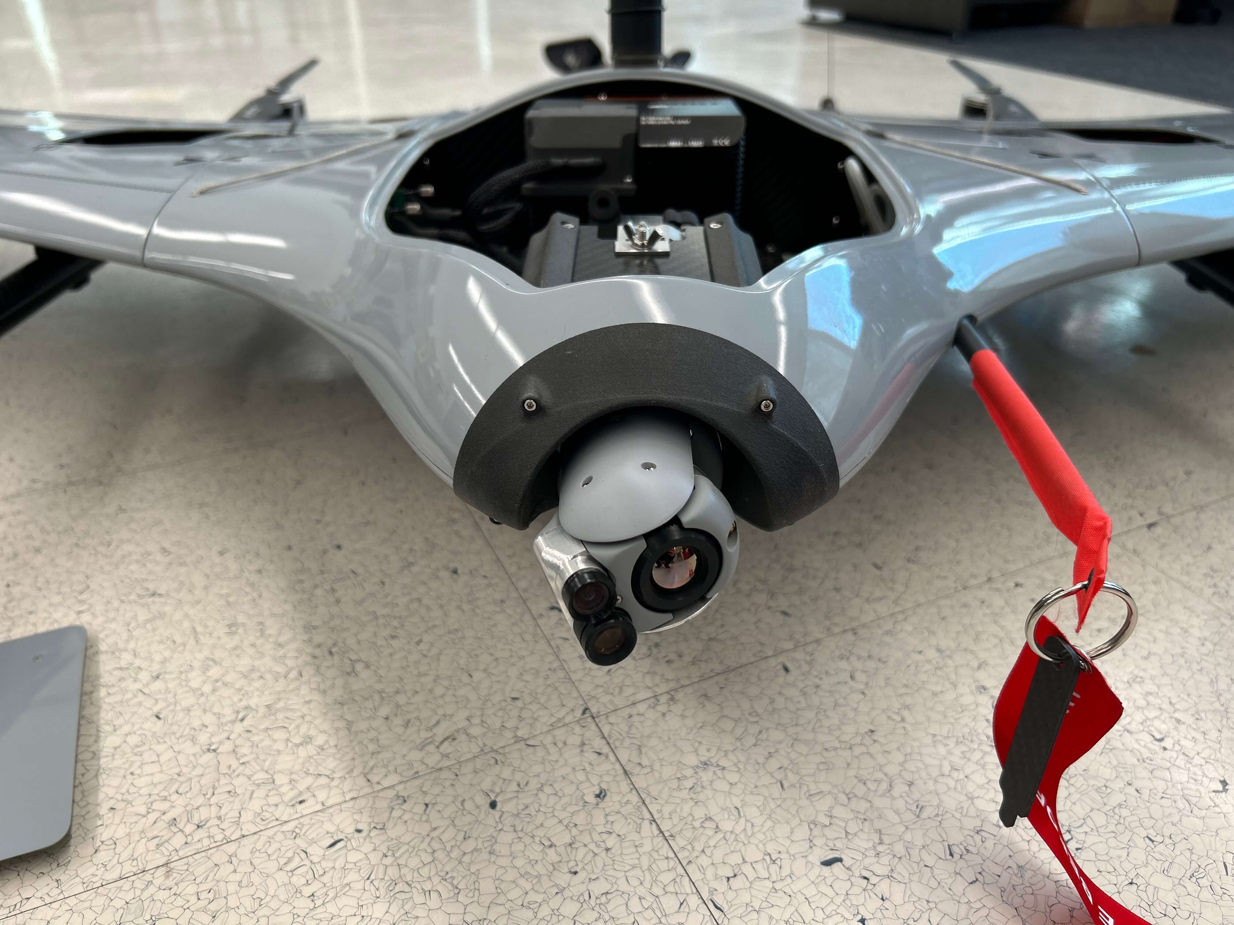
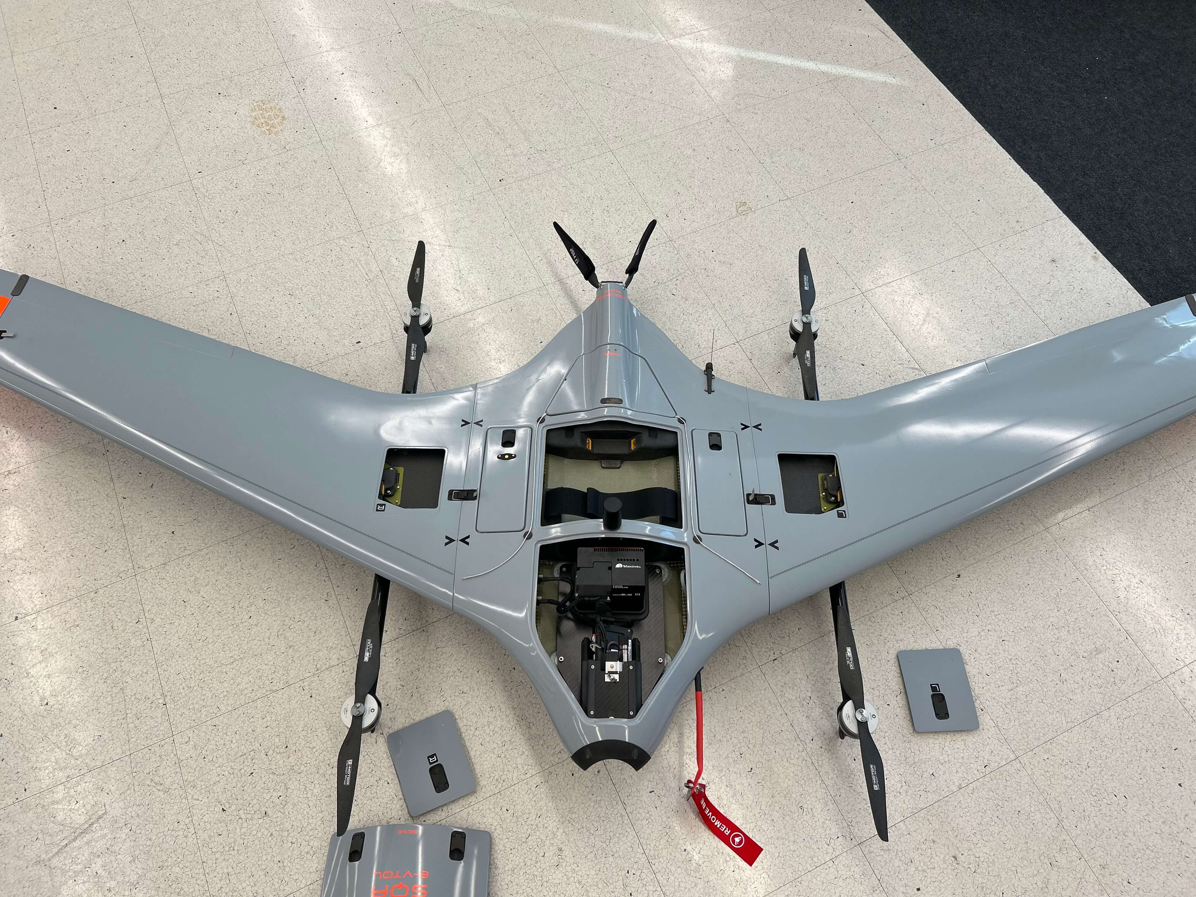
The SQA eVTOL is a multi-role electric Vertical Take-Off and Landing (eVTOL) UAS with an advanced Blended Wing Body (BWB) airframe and 2 wing detachable booms for vertical lift thrust. The high-end composite materials used for the airframe construction provides a high degree of ruggedness and a low detection radar signature.
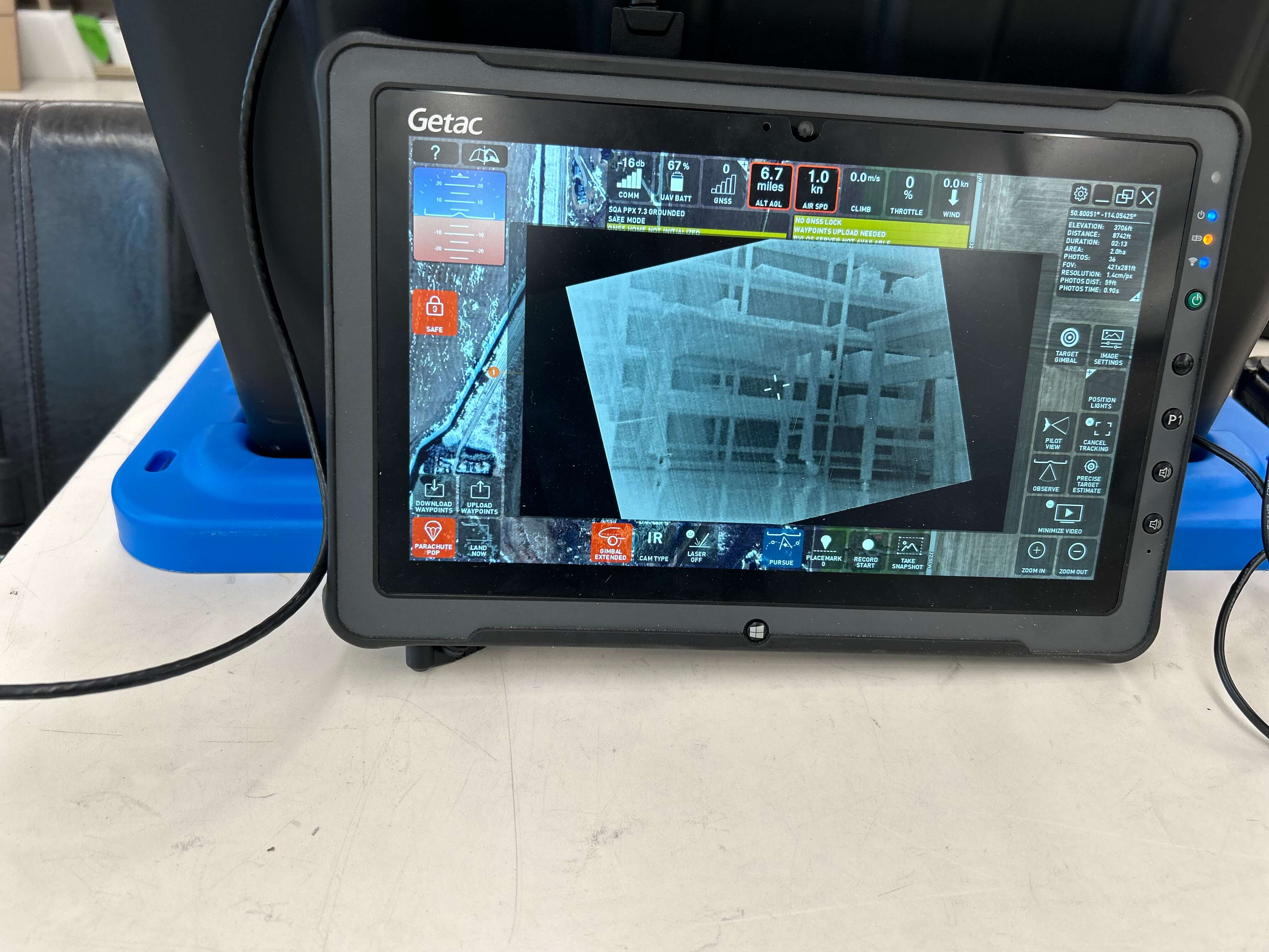
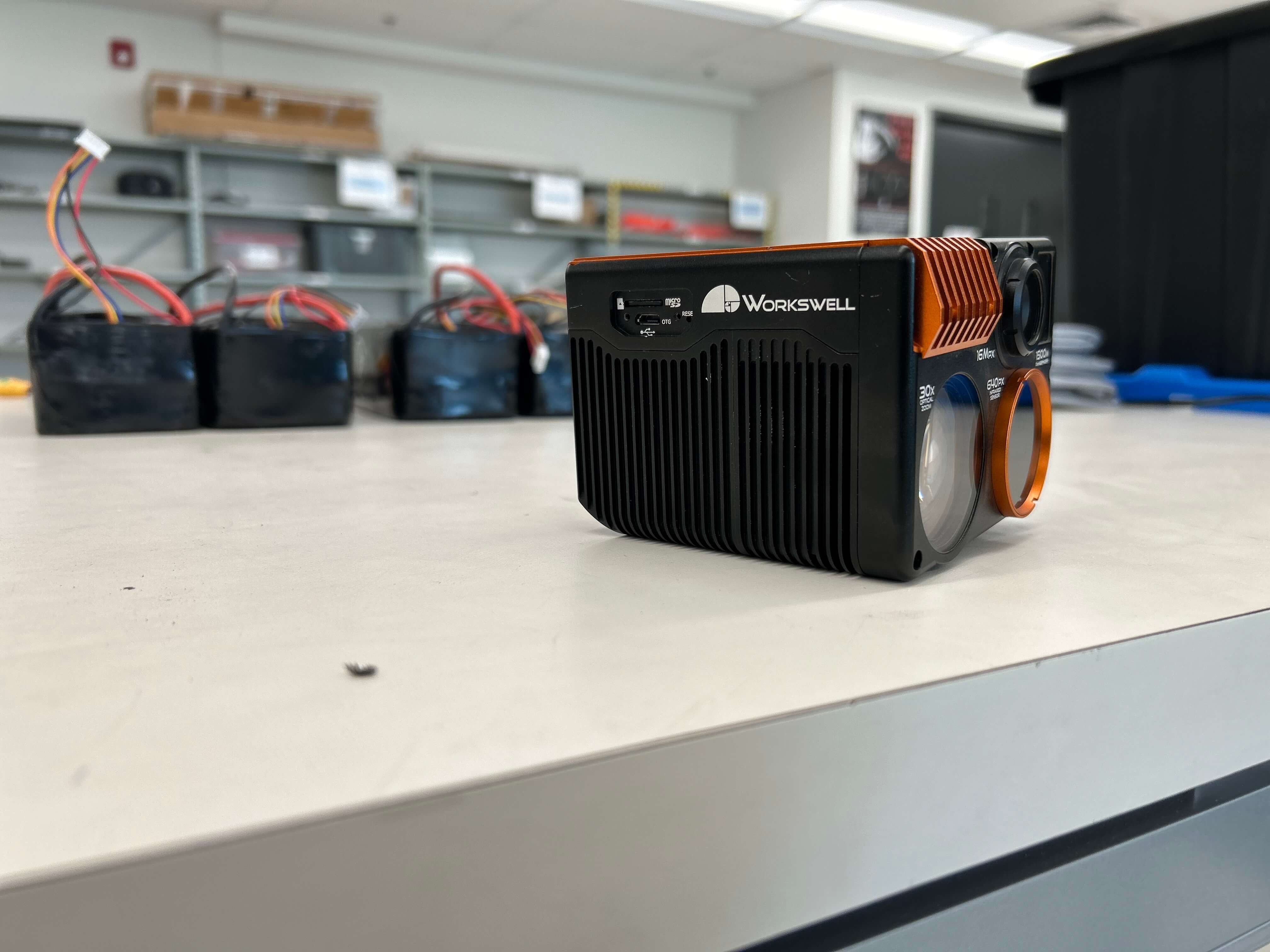
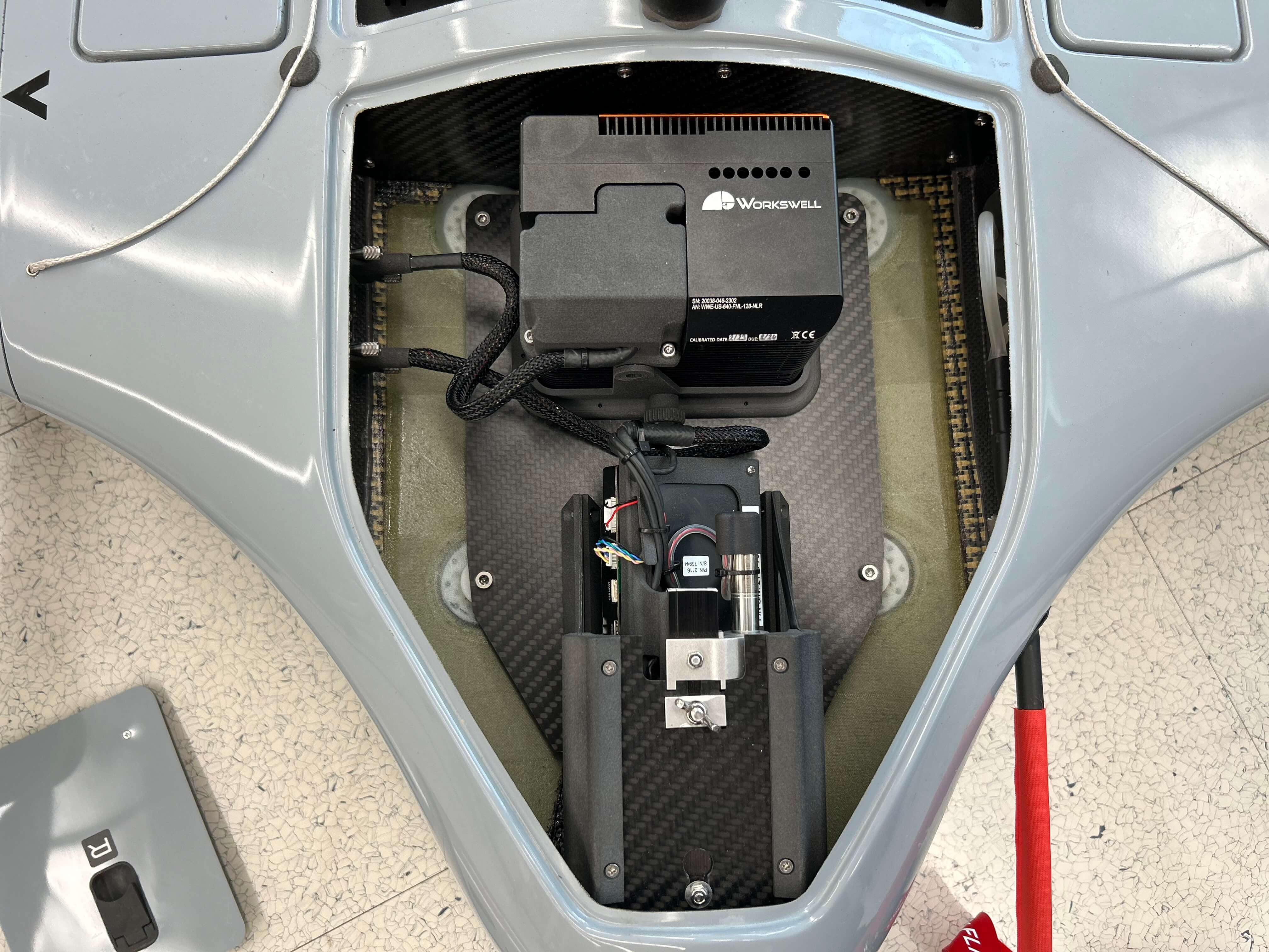
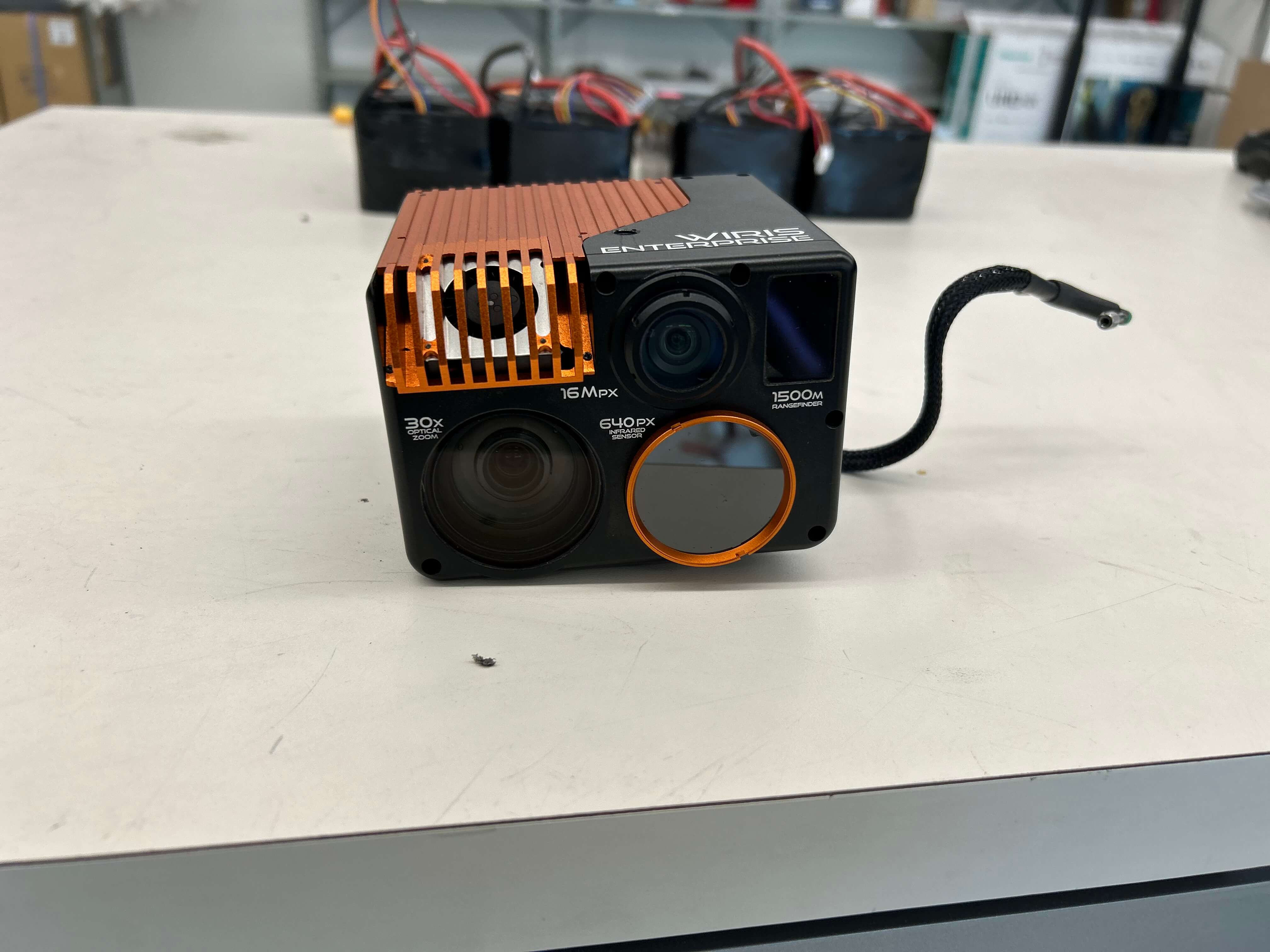
Defined as a multi-role UAS platform by C-Astral Aerospace, the SQA eVTOL is equipped with an EO/IR gyro-stabilized micro-gimbal and with optional secondary sensor or other electronic equipment for additional mission purposes in the airframe bay.
The SQA eVTOL is also equipped with the latest generation DYN Micro Datalink radio control with live audio / 4K video transmission carried over a broadband MANET mesh network with AES encryption. The simultaneous transmission of metadata allows the integration of tactical data into situational awareness software and BMS suites (i.e. proprietary battle management system or Android Team Awareness Kit). The latest generation of autopilot with hardened GPS navigation system is integrated for navigation, in GPS denied environment.
It can be operated by 1 or 2 operators for a complete spectrum of intelligence mission:
- Intelligence, Surveillance and Reconnaissance (ISR)
- Target acquisition ISTAR
- Close air support (CAS)
- JTAC (Joint Terminal Attack Controller)
- Tactical Signals Intelligence SIGINT (optional payload)
- Features Precise VTOL takeoff and landing
- Superior aerodynamic efficiency
- Up to 3h endurance*
- Flight range up to 180 km
- Video/Datalink range up to 40 km
- Silent & Stealth
- GNSS jamming / spoofing mitigation
- Best in class stabilized payload
- Quick release - detachable VTOL booms
- Automated digital preflight checklist
- Flight ready in less than 5 min
- Ability to track, Geo-register or Lock targets
*In an ideal weather condition, battery health and system performance.
Applications
- Low intensity conflict zone control
- Classical ISR
- Complex military level ISR
- Over the hill observation
- Fire control
- Night surveillance
- Battlefield management
- Moving target detection and tracking
- Search and rescue
- First responders
- Firefighting
- Remote sensing / aero photogrammetry
- LIDAR sensor option
- Infrastructure control
- Pipeline monitoring
- Woods and landscape management
- Flood monitoring
- Civil defense
- Anti Poaching
Documentation and training materials can be provided and transmitted electronically on request up on purchase
Gallery
Request a Quote
Get in touch directly with our sales team
Join +15K active subscribers
Stay in the loop! No spam. Ever.


Company
Aerial Survey Products
Aircraft Marketplace
Cookie Preferences
