miniRANGER-LITE
Availability
Description
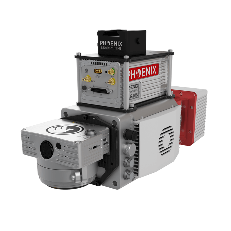
PHOENIX miniRANGER-LITE
Riegl Inside! This complete system incorporates the Riegl minivux-1UAV laser scanner.
This system features an impressive recommended AGL of up to 75 meters, filling a major AGL gap in the ultra-lightweight UAV LiDAR market.
With the photogrammetry package, operators of mid-size multirotors, like the DJI M600 Pro or the DJI M300 RTK, can now simultaneously acquire survey-grade LiDAR data and high-resolution 42 MP RTK photogrammetry at up to 100 m operating flight altitude. With options for photogrammetry, multispectral, hyperspectral, and thermal imaging, the miniRANGER-LITE is one of Phoenix’s most popular and flexible systems. This system is available in UAV, vehicle, and backpack configurations.
Featuring the new Phoenix LiDAR AIR NavBox
This ultra-lightweight box greatly increases flexibility in key areas:
- Reducing weight to allow longer flight-times on lighter UAVs.
- Improved data throughput to accommodate multiple sensors producing more data as pixel count and pulse repetition frequencies increase.
The new Phoenix LiDAR AIR NavBox offers the most industry-altering capabilities in a tiny box not much bigger than a standard-size computer mouse.
- Dimensions: 60 x 125 x 50 mm
- Weight
- 450g
- Control via button, 4g, wifi or ethernet
Gallery
.png)

Request a Quote
Get in touch directly with our sales team
Join +15K active subscribers
Stay in the loop! No spam. Ever.


Company
Aerial Survey Products
Aircraft Marketplace
Cookie Preferences
