Available
Not Available
Not Available
Available
Available

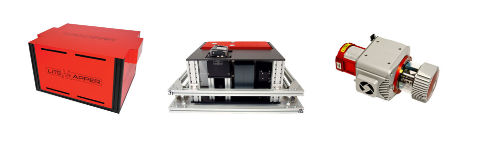
IGI LiteMapper
Availability
Description
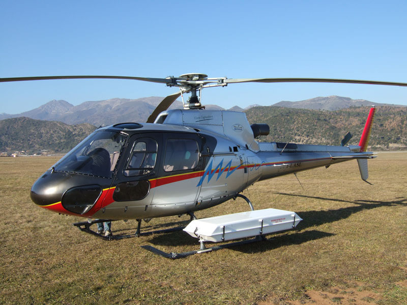
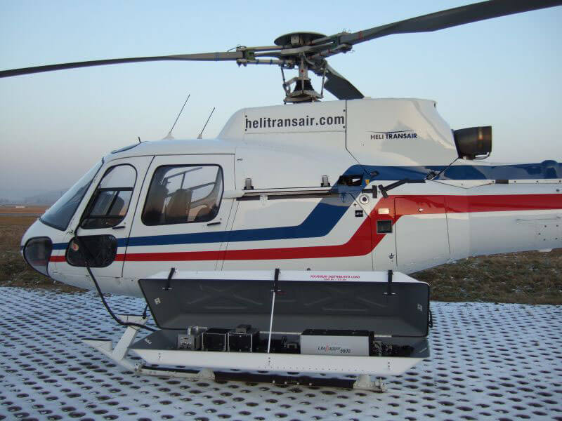
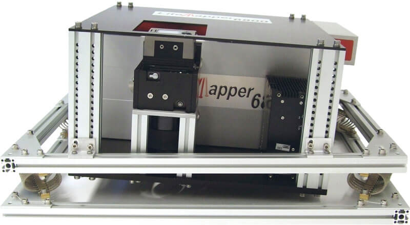
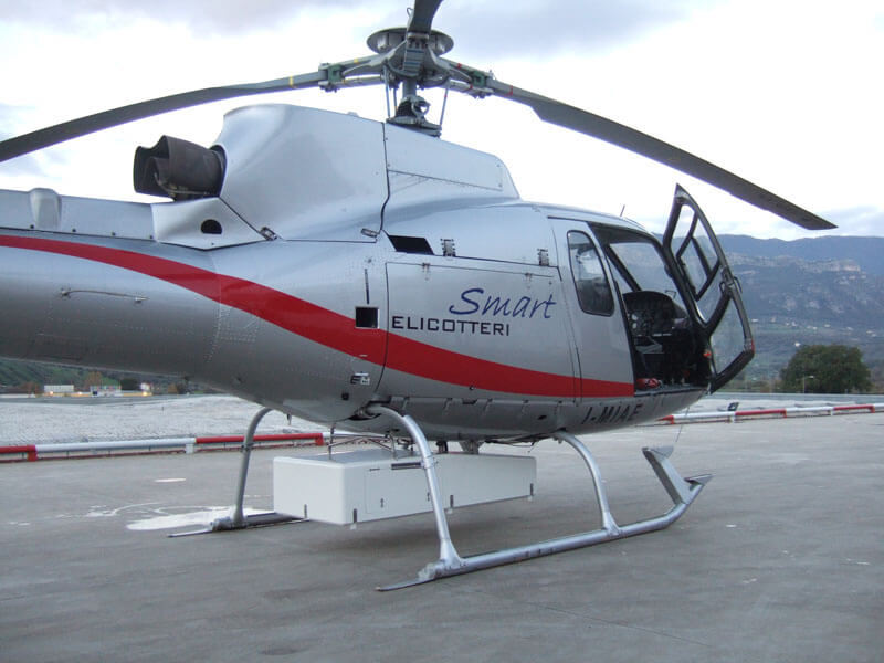
New with Warranty! IGI LiteMapper - Airborne Laser Scanning Solution for Corridor and Wide-Area Mapping
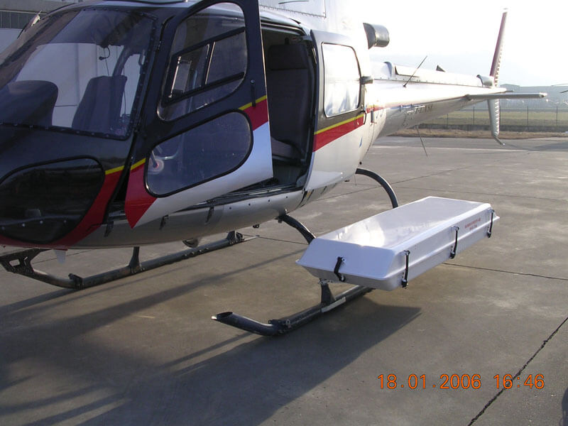
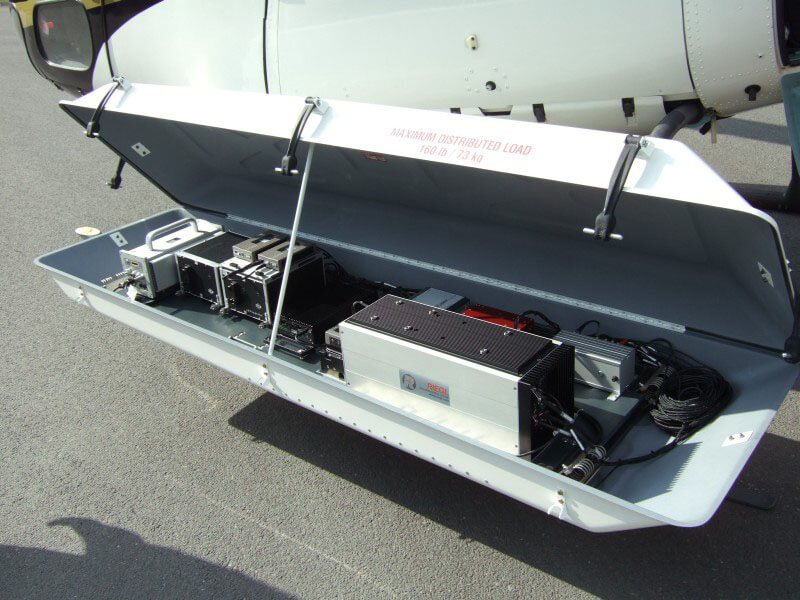
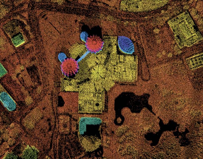
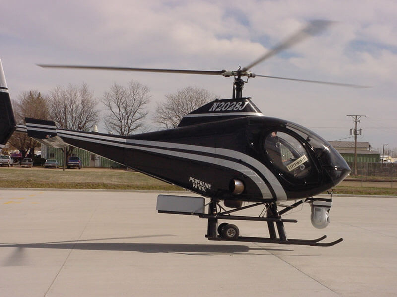
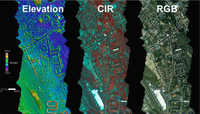
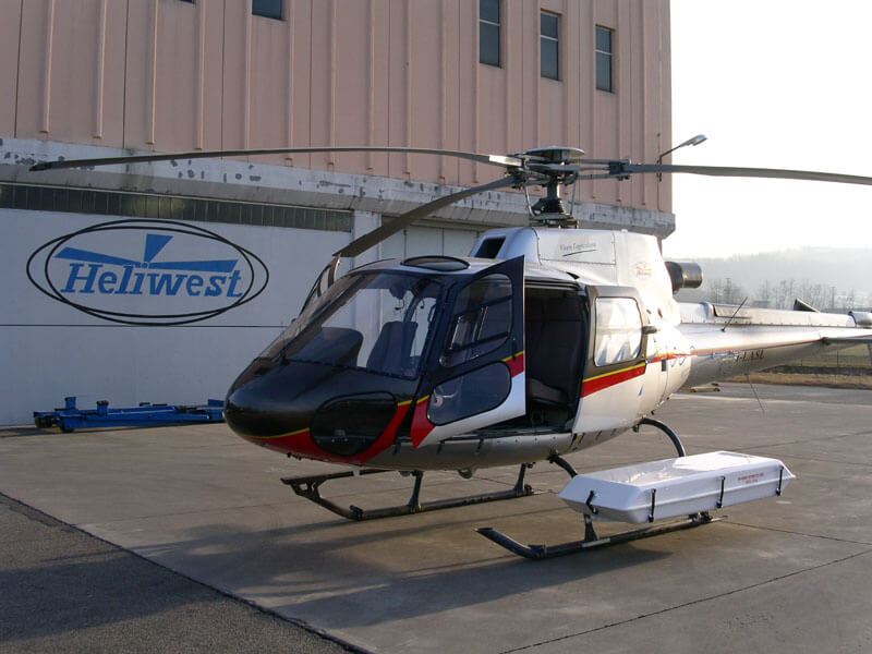
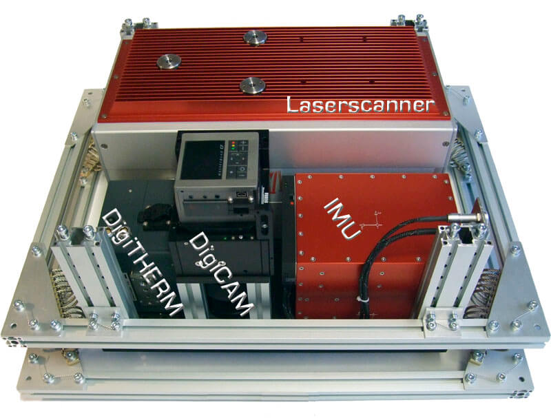
The IGI LiteMapper is an adaptable, lightweight mapping solution that combines durability with compact design. This versatile system's robust yet portable construction allows for deployment across a wide range of aircraft—from conventional planes and helicopters to ultralight aircraft, gyroplanes, and remote piloted aircraft systems (RPAS). Every installation features sophisticated vibration damping platforms or stabilized mounts, ensuring optimal performance regardless of the aircraft platform.
Features Include:
- LiDAR Sensor Accuracy: Up to 0.2cm
- Operation Altitude AGL: Up to 4700m
- Pulse Repetition Rate: Up to 2MHz
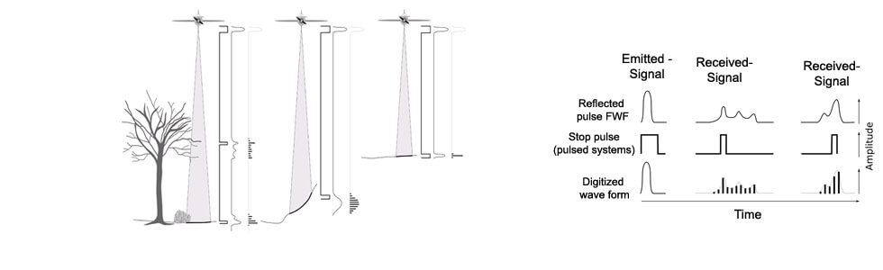
- Waveform Processing: Online / Smart/ Full
- Multiple Time Around Processing
- IGI LMtrack - Online LiDAR Coverage
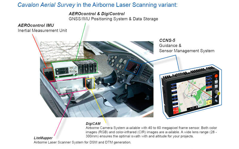
- Touch-Screen or Tablet as Operator Screen
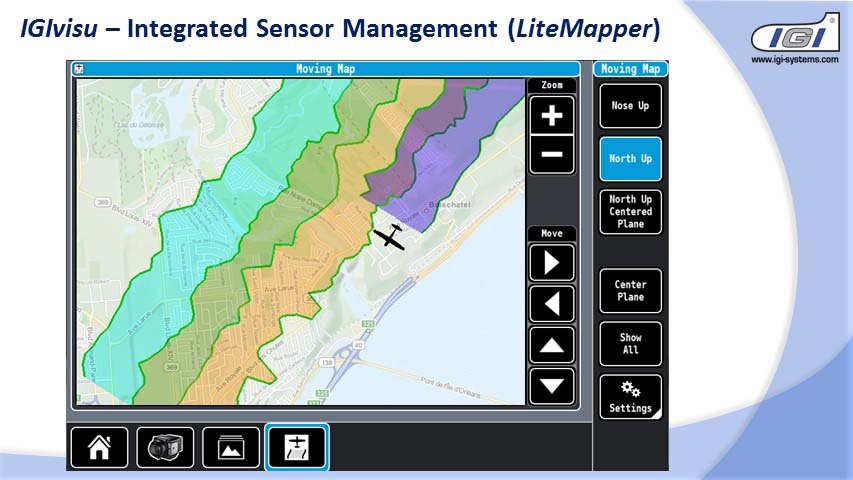
- Integrated Sensor management (IGIvisu)
- Integrated GNSS/IMU System (IGI AEROcontrol)
- Integrated Mission Planning & Flight Guidance Solution (IGI CCNS-5 with IGIplan)
Gallery

No items found.
Request a Quote
Get in touch directly with our sales team
Newsletter
Join +15K active subscribers
Stay in the loop! No spam. Ever.


Company
Aerial Survey Products
Aircraft Marketplace
Cookie Preferences
