571 - Ranger LR with Heavy Lift Drone
Availability
Description
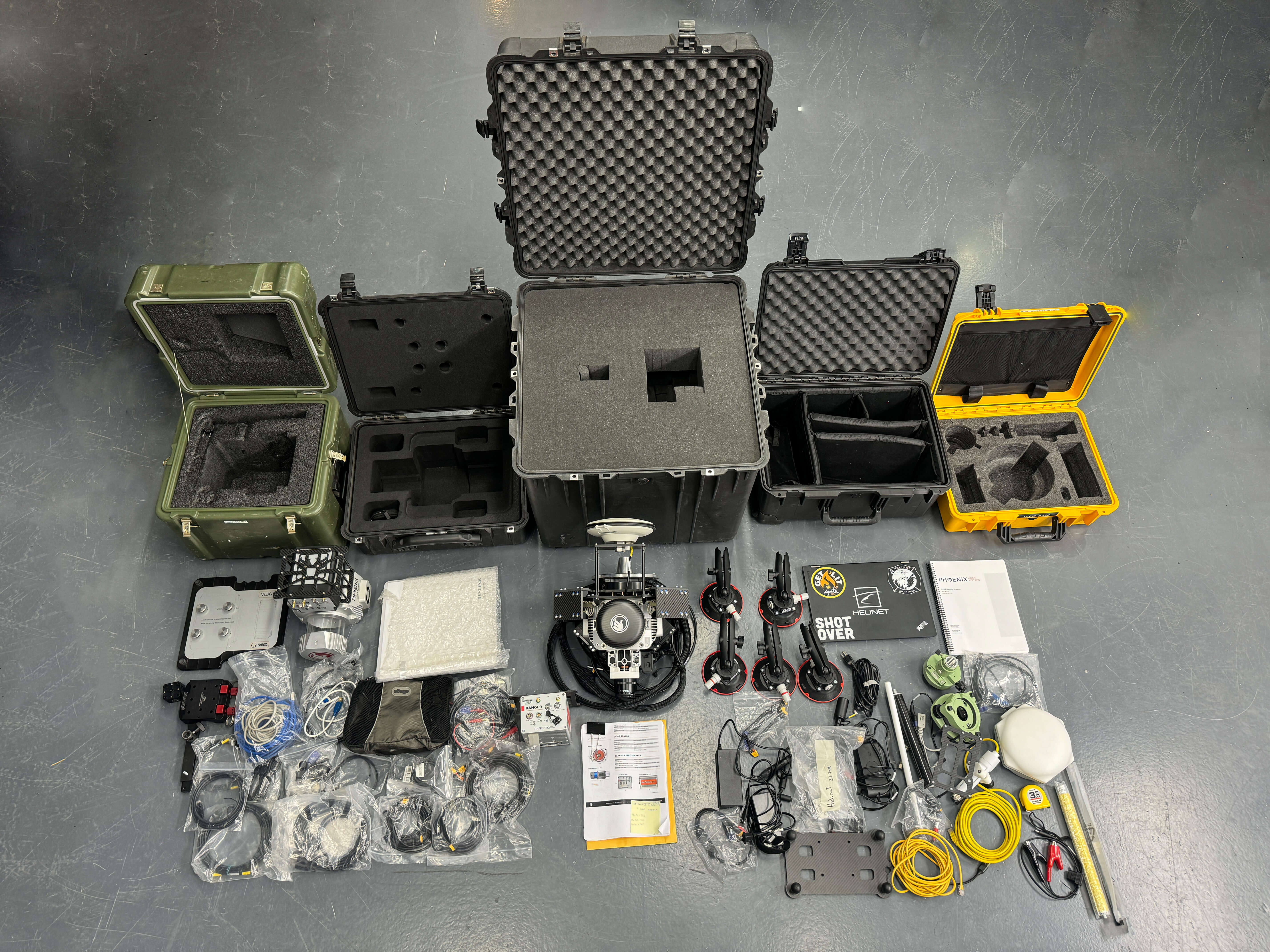
Turnkey 2017 Phoenix Ranger LR with Drone - only used twice!
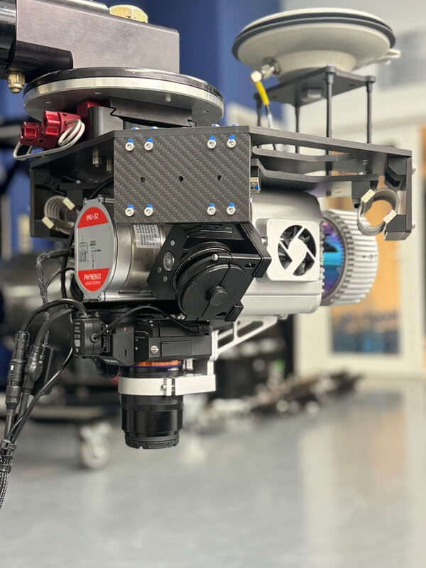
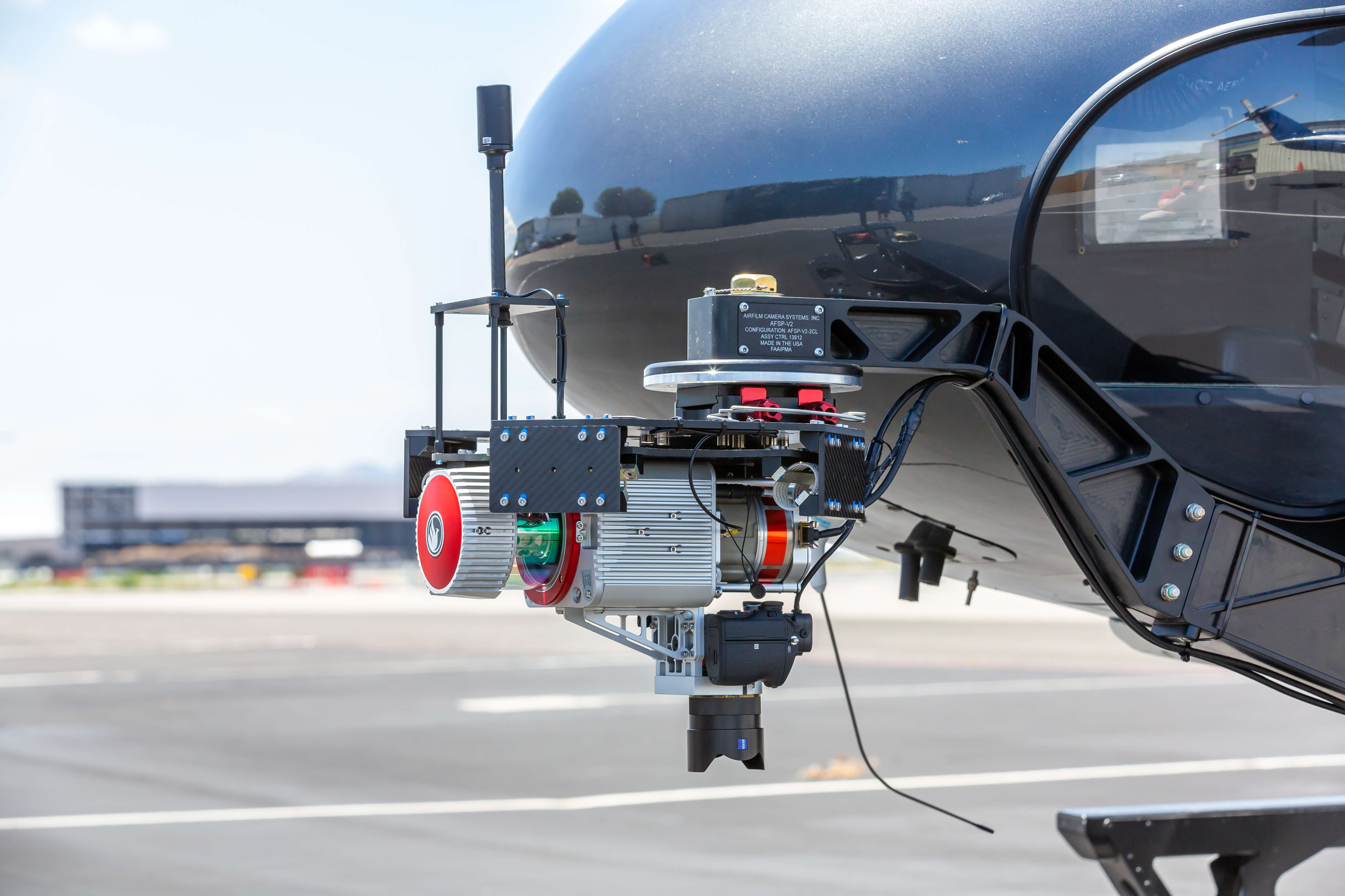
- Integrated with RIEGL VUX-1, IMU-52, Novatel Pinwheel antenna, w/Sony A7 and (2) A6000 for oblique shots and Phoenix Nav box for helicopter applications
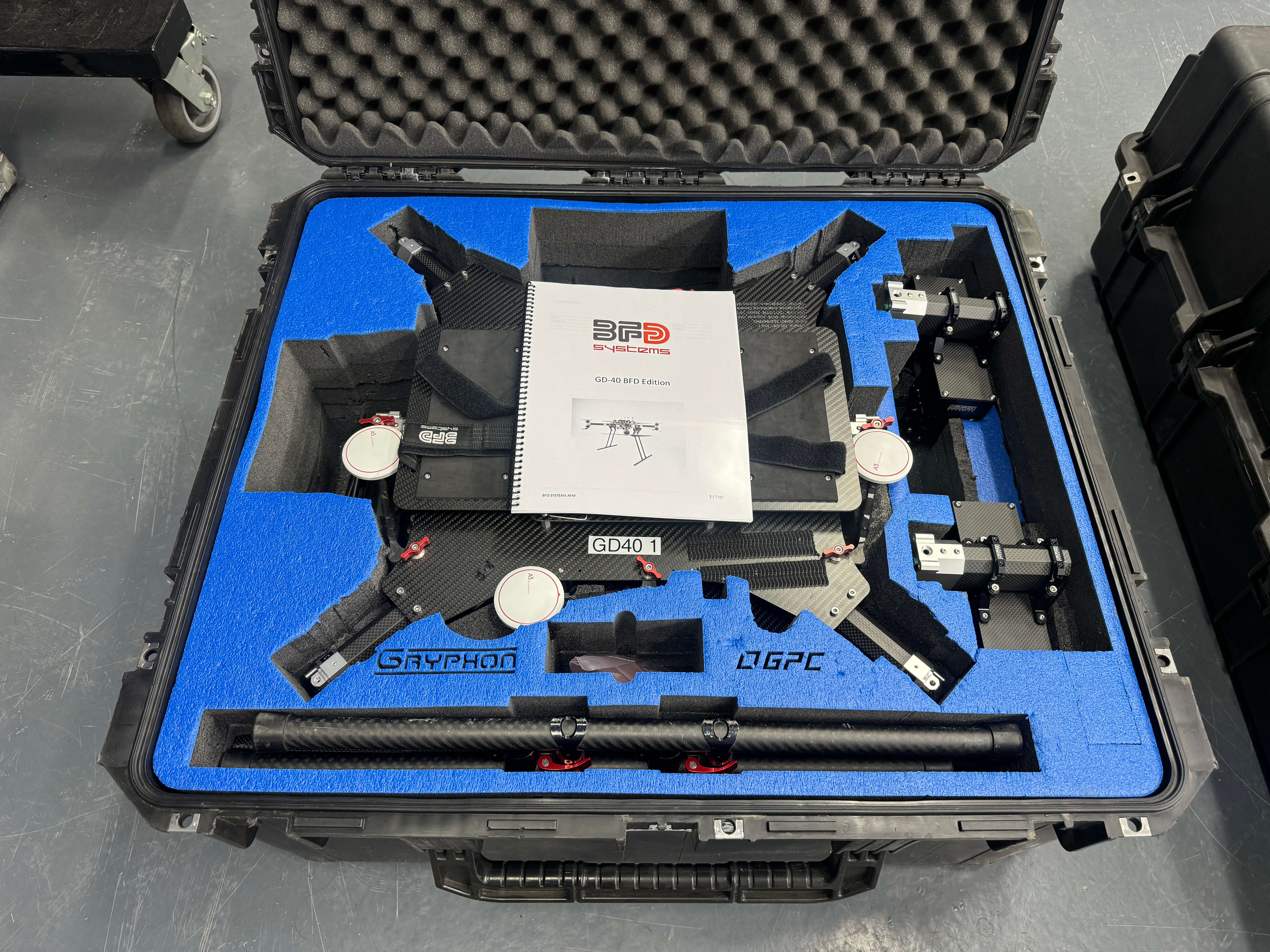
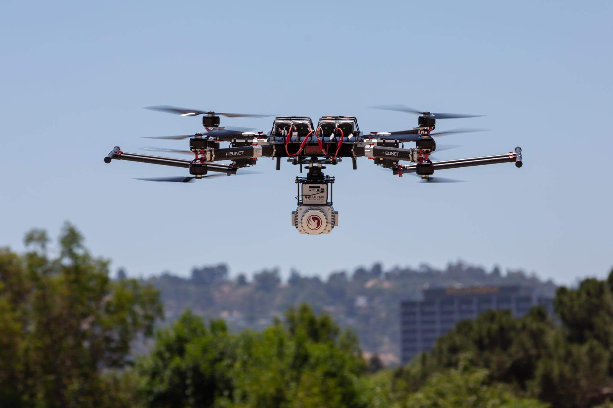
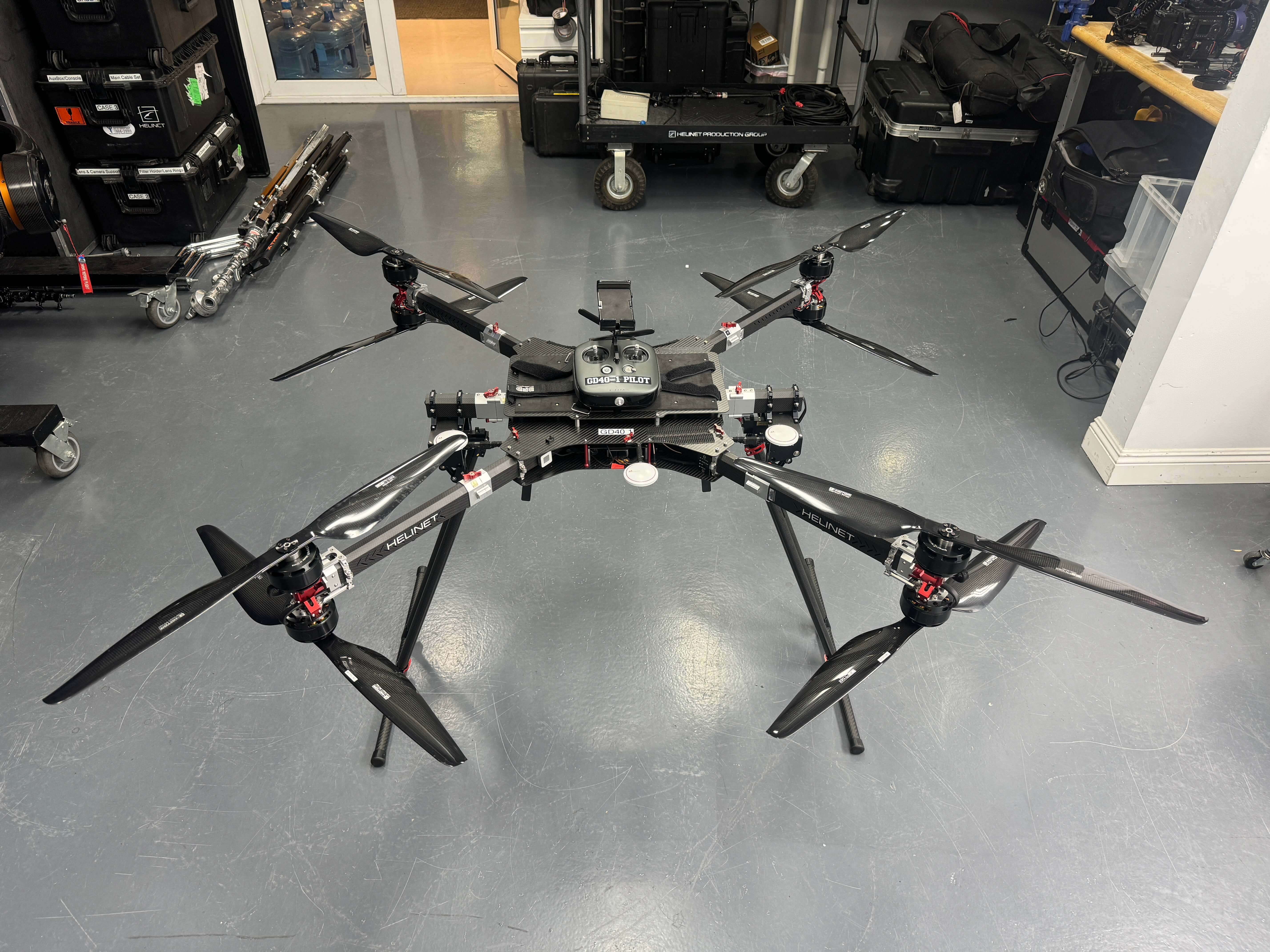
- BFD Heavy Lift GD-40 UAV Drone (Included!)
- Includes:
- Dummy Ranger Body for Drone testing
- Air Film mount (with STC) for helicopter use
- GNSS Base Station
- Laptop with Spatial Explorer v 4.0.3,
- 5X vehicle attachment suction cups
- Miscellaneous cables and chargers
- 5X Pelican cases
RUGGED BUILD WITH PERFECT SCAN LINES
The RANGER LR is the Long Range system configuration of our RANGER Series. Designed for the most demanding mapping applications, the RANGER LR features a powerful 1,350 nm laser that penetrates dense vegetation at high speeds and altitudes in large scan regions.
Absolute Accuracy
25-35 mm RMSE @ 250m Range
PP Attitude Heading RMS Error
0.007 / 0.009° IMU options
Weight
5.3 kg / 11.7 lbs.
Dimensions
30.8 L x 18 W x 12.9 H (cm)
Laser Range
1350 m @ 60% Reflectivity
Scan Rate
up to 750k shots/s, up to 7 return
LiDAR SENSOR LASER PROPERTIES 1550 nm Class 1 (eye safe)
RANGE MIN 5 m
LASER BEAM FOOTPRINT 50 mm @ 100 m, 150 mm @ 250 m, 250 mm @ 500 m
MAX EFFECTIVE MEASUREMENT RATE 750,000 meas./s
FIELD OF VIEW 360°
ACCURACY 15 mm one Signma @ 150m
Multi-Platform
Mount your Phoenix LiDAR integrated systems on aircrafts, drones, vehicles, vessels and even backpacks.
Real-Time Point Clouds
Phoenix LiDAR leverages the latest laser mapping technology to enable users to acquire precise, survey-grade data & review in real-time with live 3D color point clouds.
Multi-Application
Capture topography, inspect utility installations and construction sites, map disaster areas, conduct research for urban development & more.
Primary Applications
Use Phoenix LiDAR solutions to capture topography, inspect utility installations and construction sites, map disaster areas, conduct research for urban development and more.
• AEC / Civil Infrastructure / Urban Planning
• Forestry / Agriculture
• Utility Installations
• Public Safety
• Transportation
• General Survey
Gallery

.jpeg)
Request a Quote
Get in touch directly with our sales team
Join +15K active subscribers
Stay in the loop! No spam. Ever.


Company
Aerial Survey Products
Aircraft Marketplace
Cookie Preferences
