520 - UrbanMapper-2 Performance
Availability
Description
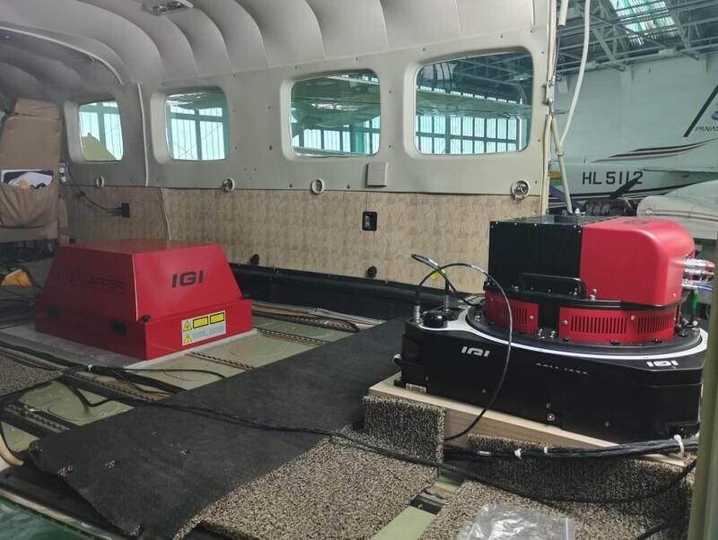
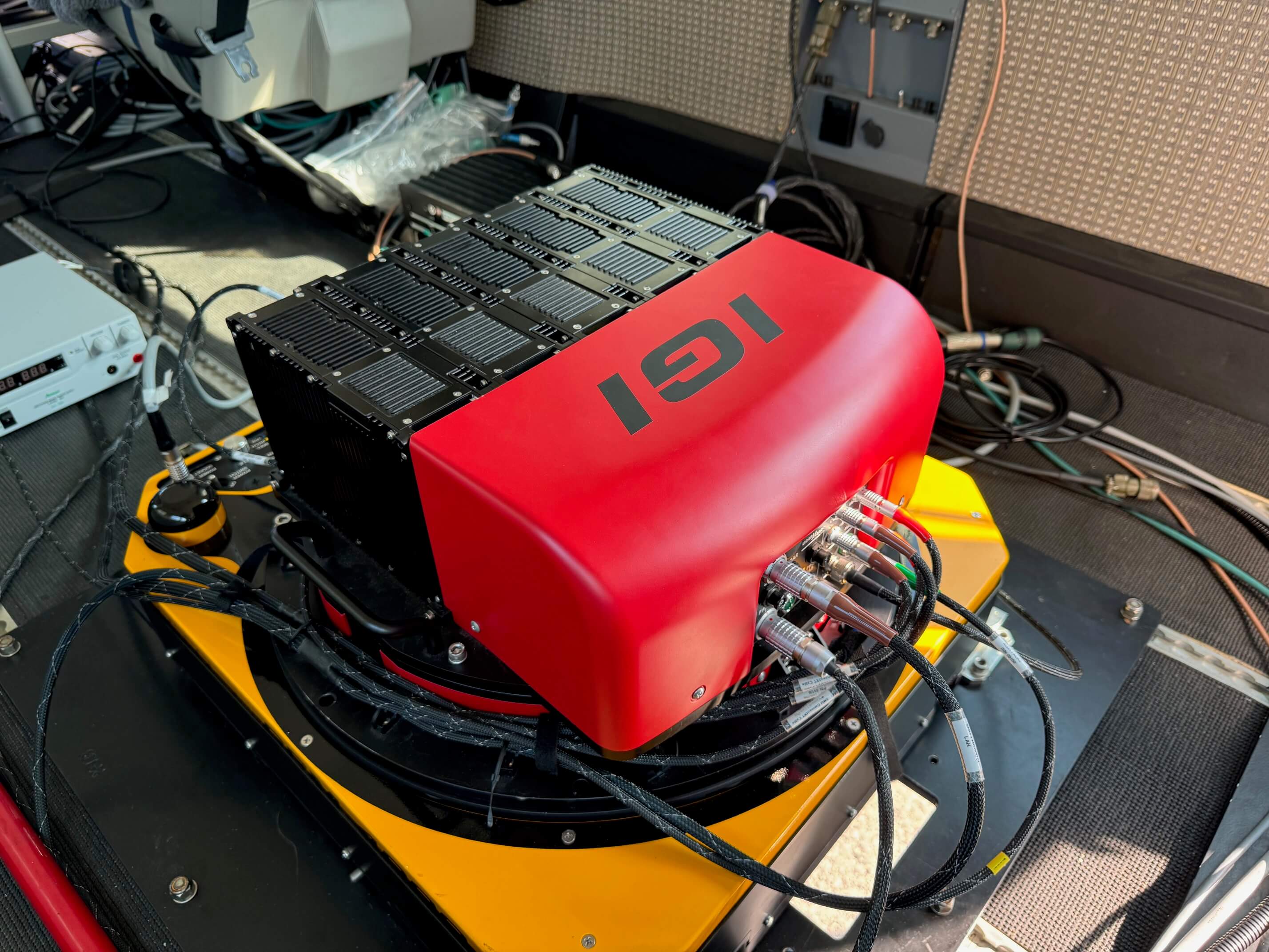
IGI-40518IGI UrbanMapper-2 Performance Aerial Camera System
Complete System For Sale (NEW with Warranty!) or Rental Includes:
- Photogrammetric 2-IN-1 Aerial Camera System
- Large Format + Oblique Views to all sides
- Professional Phase One Digital Aerial Camera Heads
- Coverage of 34,500 x 14,100 pixels
- Coverage of 14,204 x 10,652 pixels (obliques)
- BSI-CMOS Sensor Technology
- FMC by BCM (Blur Control Management)
- Channels: RGBI, RGB, CIR, NIR, 4x RGB oblique
- Pixel Size: 3.76µm
- High Frame Rate: 0.6 seconds
- High Dynamic Range > 83db
- 3x Rhodenstock RS lens, f=90mm, RGB
- 4x Schneider-Kreuznach RS lens, f=110mm, RGB
- 1x PhaseOne RSM lens, f=35mm, NIR
- Exposure times down to 1/2000s
- IGI Precise Focussing
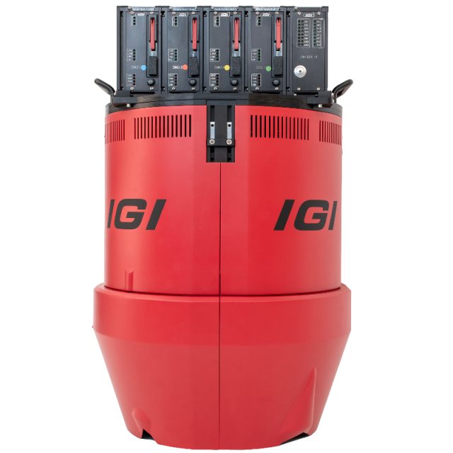
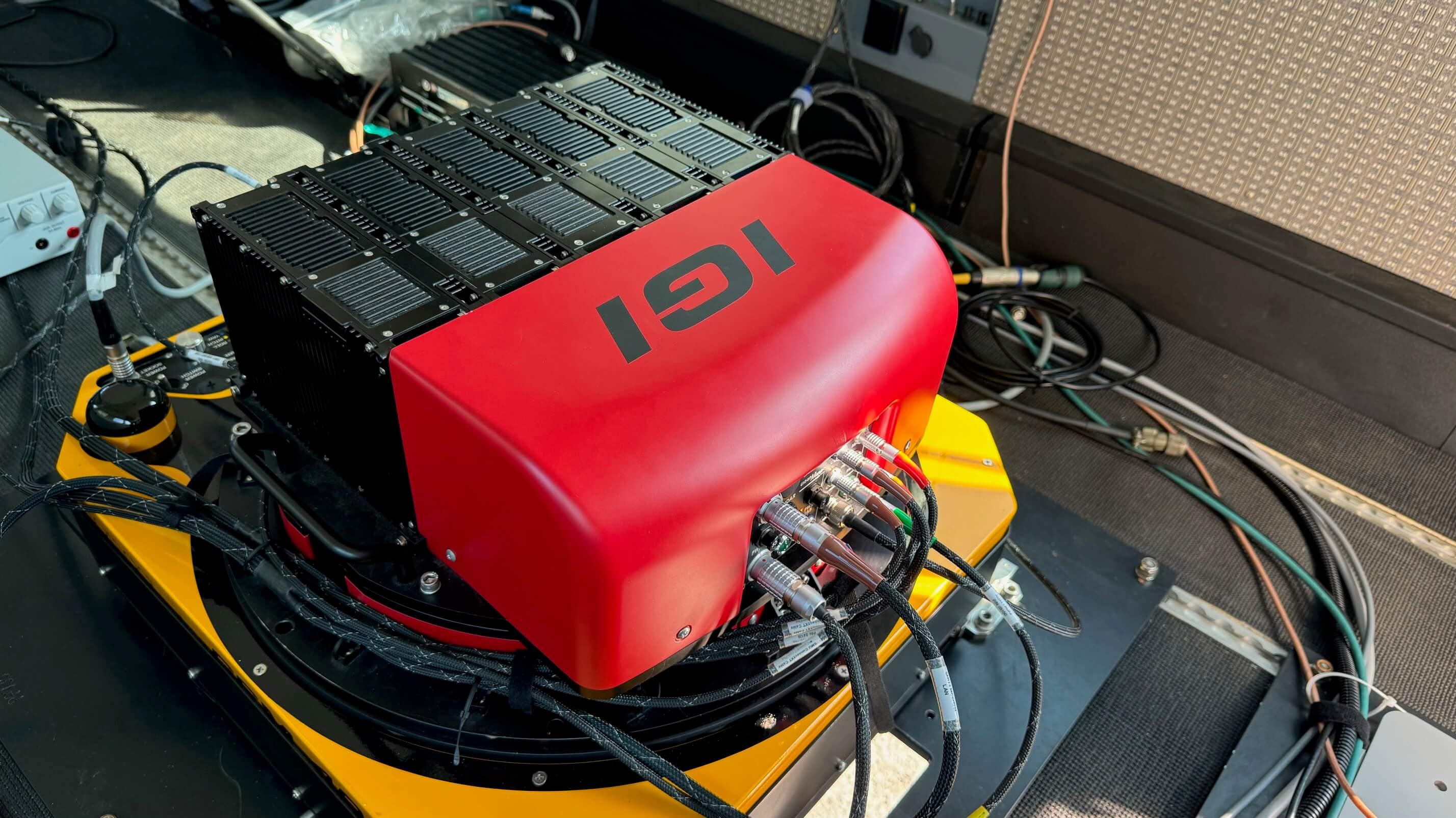
- 4x DigiControl SMU-2 for precise camera control & synchronisation
- 2 sets of 16TB (4x 2+2TB) hot-plug SSD Storage Units with IGI Redundant Storage Technology
- 20 inch TFT Operator touch-screen incl. RAM mounting
- IGIvisu - Integrated Sensor Management
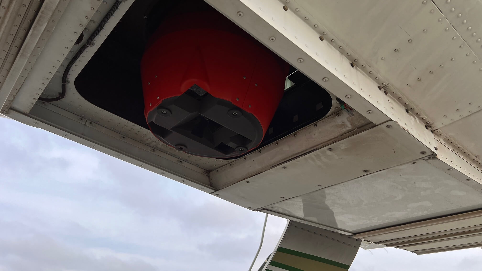
- IGI UrbanMapper Housing, can be fitted into GSM-3000/4000 or PAV80/100 gyrostabilized mount
- IGI IPS - Image Processing Software
- Set of associated cabling for power and data
GNSS/INS Positioning System: AEROcontrol / TERRAcontrol Compact FOG-II
- High-Accuracy System for Precise Positioning and Attitude Determination comprising of:
- AEROcontrol Compact FOG-II unit
- Integrated, Internal, High-End L1/L2/L-Band
- GPS/GLONASS Receiver
- Integrated FOG-based Inertial Measurement Unit
- IMU Data Rate: 256Hz
- Set of Cabling for Power and Data
AEROcontrol Precise Leveling
- Introduction of AEROcontrol IMU values into the mount to improve the stabilization accuracy incl. related cabling
GNSS/IMU Post-processing Software Package
- AEROoffice Local License Post-processing Software
- Forward/Backwards Kalman Filter Algorithm for Optimal Results
- GrafNav Local License GNSS Post-processing
Mission Planning & Flight Guidance: IGIplan Local License
- Mission Planning Software
- Automatic Flightplan Creation
- Support for aerial cameras (RGB+IR), LiDAR, thermal cameras, Radar and hyperspectral.
- Worldwide DEM Support
- Nadir & Oblique Planning
- Online GSD Classification
- Export: ASCII, Shape, DXF, Raster Map, Google...
- Editors: Map, DTM, Sensor, WMS, Coordinate System
- More than 600 local coordinate systems
- Drag and modify flight lines interactively
- Bing, Google Earth and WMS support
- 3D Nvidia graphic device recommended
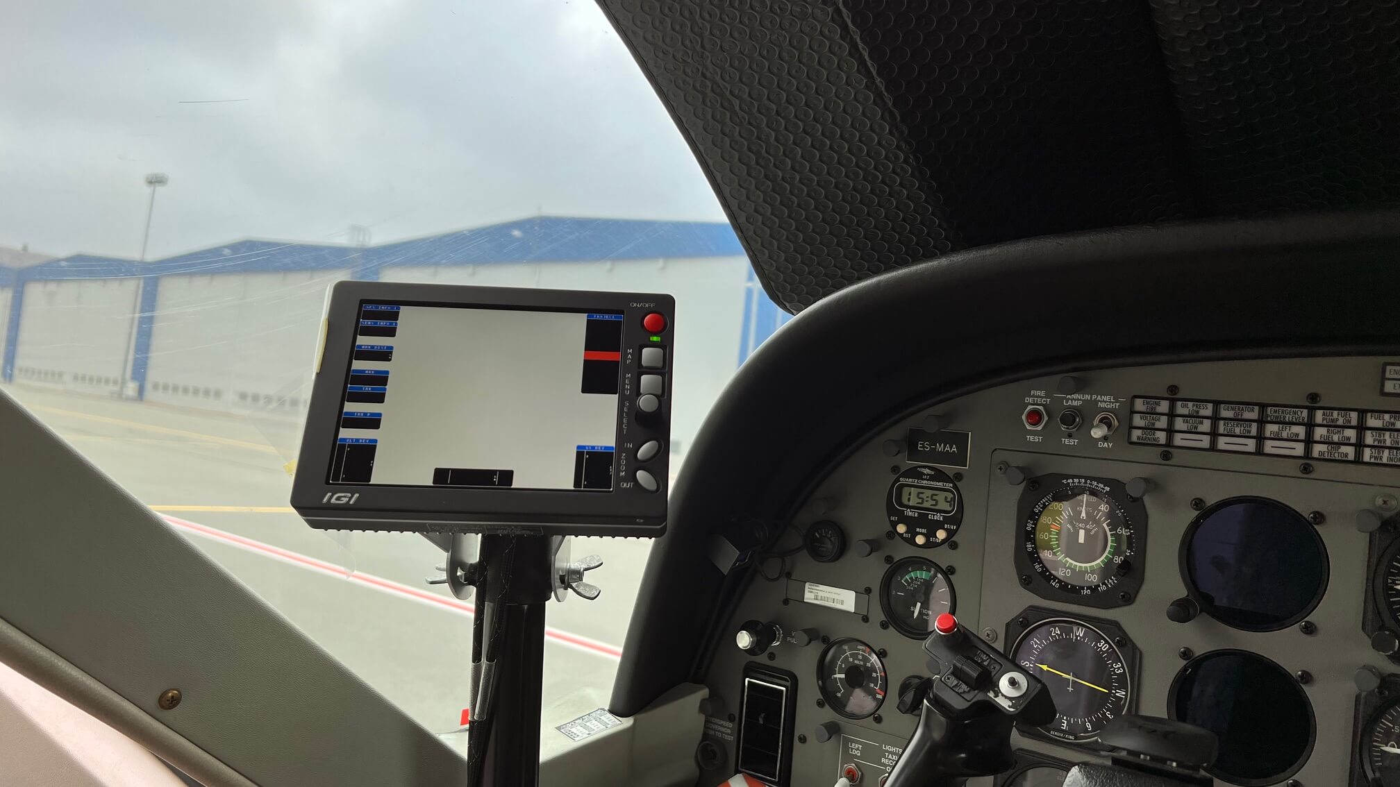
CCNS-5 Flight Guidance & Sensor Management System
- 6.5" LED display with 1024x768 pixel resolution
- ST-NLT reduces the surface reflections of ambient light and keeps the screen readable in bright sunlight
- SDCard for mission and customization storage
- Customizeable Info Boxes
- Pilot Only Missions
- Map & Approach Mode, Wind Adjustment incl. CCNS-5 customization software
- CCNS-5 - Pilot/Secondary
- CCNS-5 Terrain Following
- Additional Custom Info Box to always adapt optimally to the terrain
- SMU Connect-XT
- Connection Unit for CCNS-5 and AEROcontrol
Charged separately - not included in monthly-basis rental price:
- Calibration of DigiCAM
- Calibration with Calibration Certificate
- Prerequisite: Camera and AEROcontrol data from flight with calibration pattern to be delivered by customer
Software licenses to be provided during rental period:
- IPS - Image Processing Software7
- IGIplan
- AEROoffcie+GrafNav
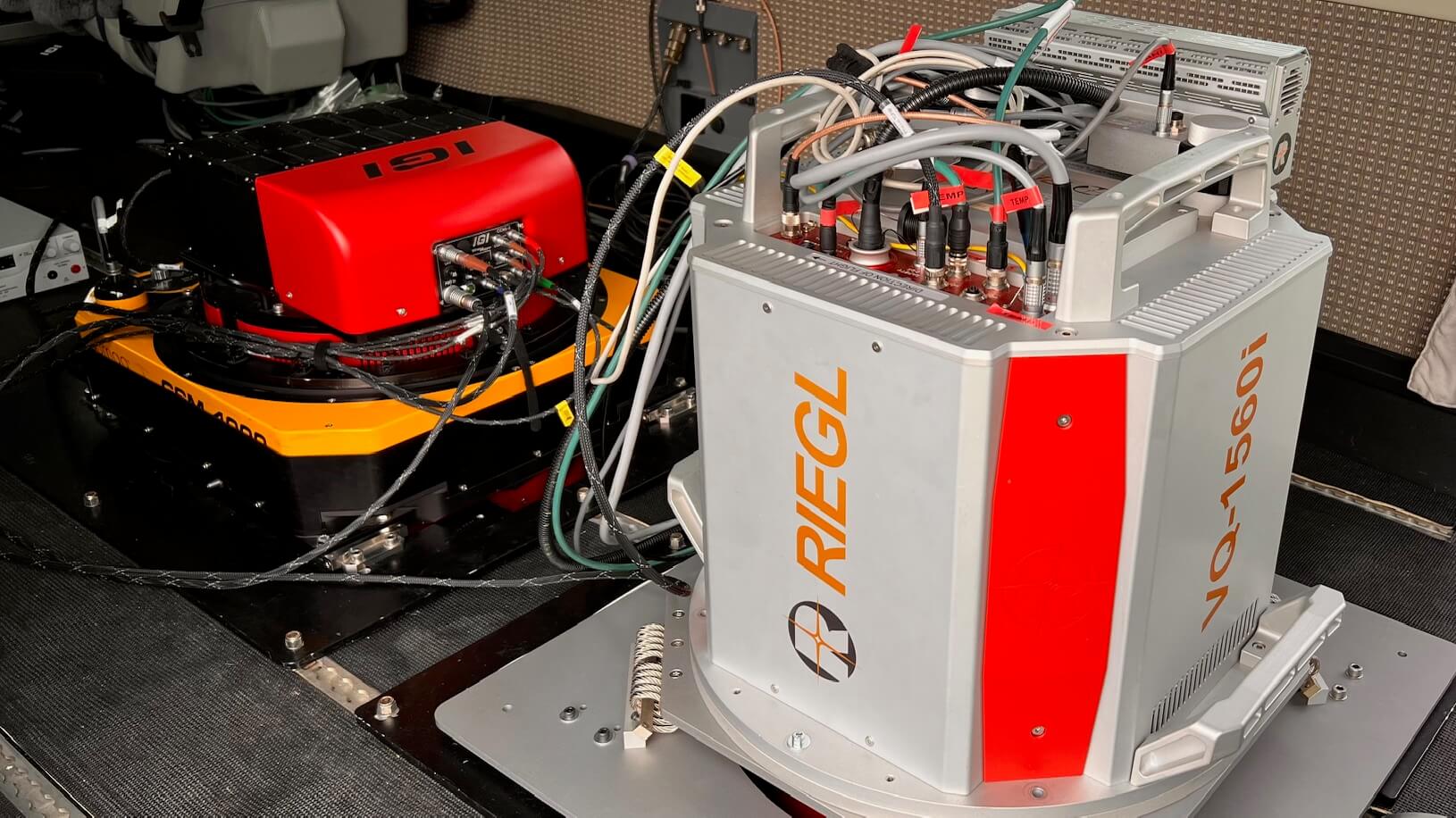
***Riegl scanner pictured is not included in the rental. This is to illustrate a potential setup with the Riegl scanner with the camera and the CCNS-5 (provided as part of the system) connected in master-slave mode. All of it, together can be then controlled via the same flight management system.
Gallery
Request a Quote
Get in touch directly with our sales team
Join +15K active subscribers
Stay in the loop! No spam. Ever.


Company
Aerial Survey Products
Aircraft Marketplace
Cookie Preferences
