
Your account is currently pending and is under review by our staff.
You've reached your limit. Upgrade to increase listings!

Explore U.S. drone laws crucial for aerial surveying, including compliance with Remote ID for tracking, Part 107 regulations and NDAA compliance.
Read Full Story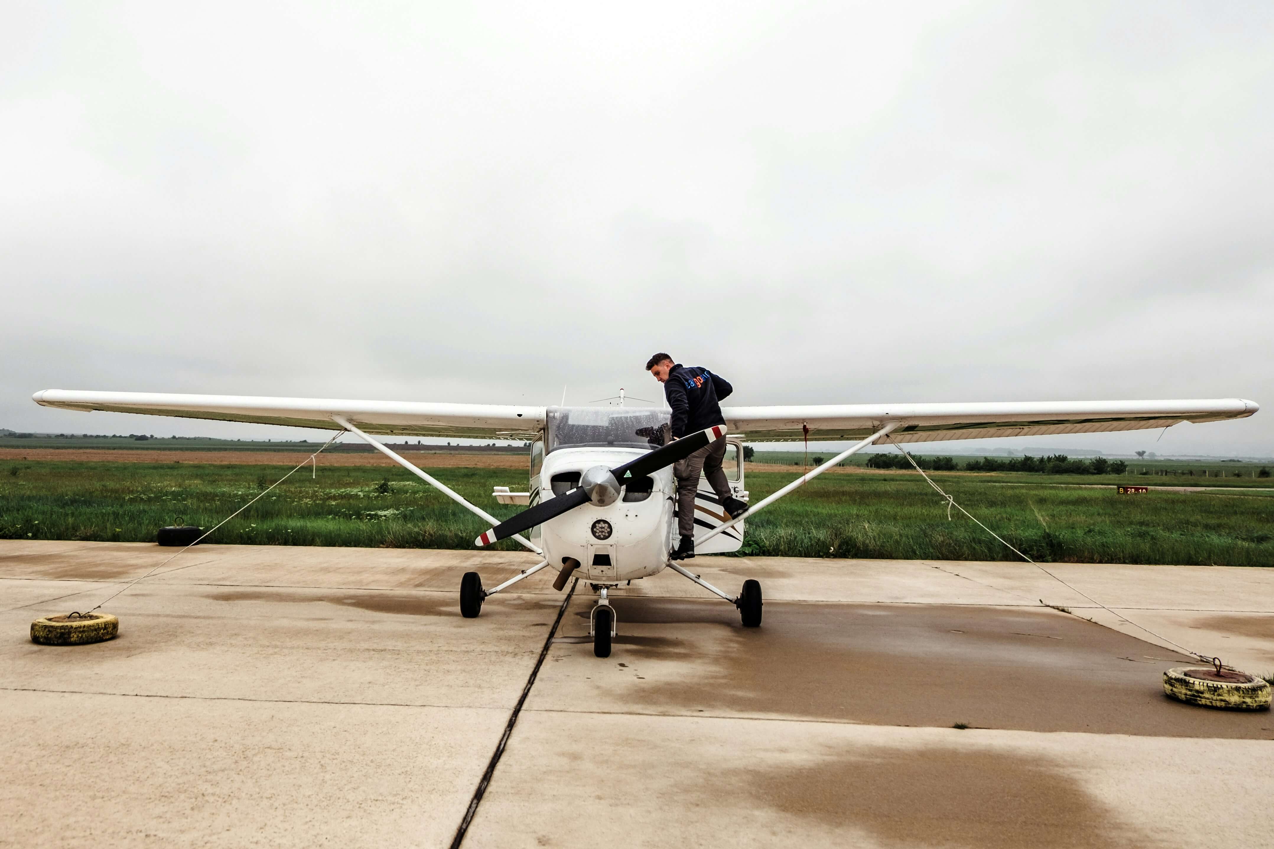
Explore the top 10 types of aerial surveying equipment, including LIDAR, photogrammetry cameras, and UAVs, for precise spatial data collection.
Read Full Story
Discover some of the best GIS software tools for aerial surveying and how to choose the right one for your needs. Learn about how GIS software can help aerial surveyors to manage, process, analyze, and communicate aerial data.
Read Full Story.png)
Unlock the full potential of aerial mapping with our new Phase One Aerial Mapping Cameras. Delve into the technical intricacies of the iXM-RS150F/iXM-RS100F brochure as we decode the features and concepts, providing you with an insider's guide to transform marketing jargon into real-world applications.
Read Full Story
Explore how Flight Management Systems (FMS) are revolutionizing aerial surveys. From precision navigation to advanced autopilot features and data management, discover the technology shaping aerial survey data collection.
Read Full Story
Discover the world of thermal camera sensors in aerial surveying! Explore types, applications, and advantages of thermal camera sensors for your surveys.
Read Full Story
Explore the intricate workings of aerial cameras in aerial surveying, from diverse camera types to the significance of color filter arrays. Learn how pan sharpening and the Bayer pattern enhance image quality. Discover the challenges and benefits of aerial cameras for your aerial survey applications.
Read Full Story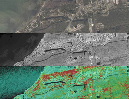
Discover the Power of Geospatial Technology: From Data Acquisition to Decision-Making. Explore the significance and applications of geospatial technology and learn how leading technologies like remote sensing, lidar, and GIS are shaping industries.
Read Full Story.jpeg)
Explore the benefits of Survey Equipment Rental and discover how to get the most out of your rentals for survey aircraft, aerial survey lidar, and large-format cameras.
Read Full Story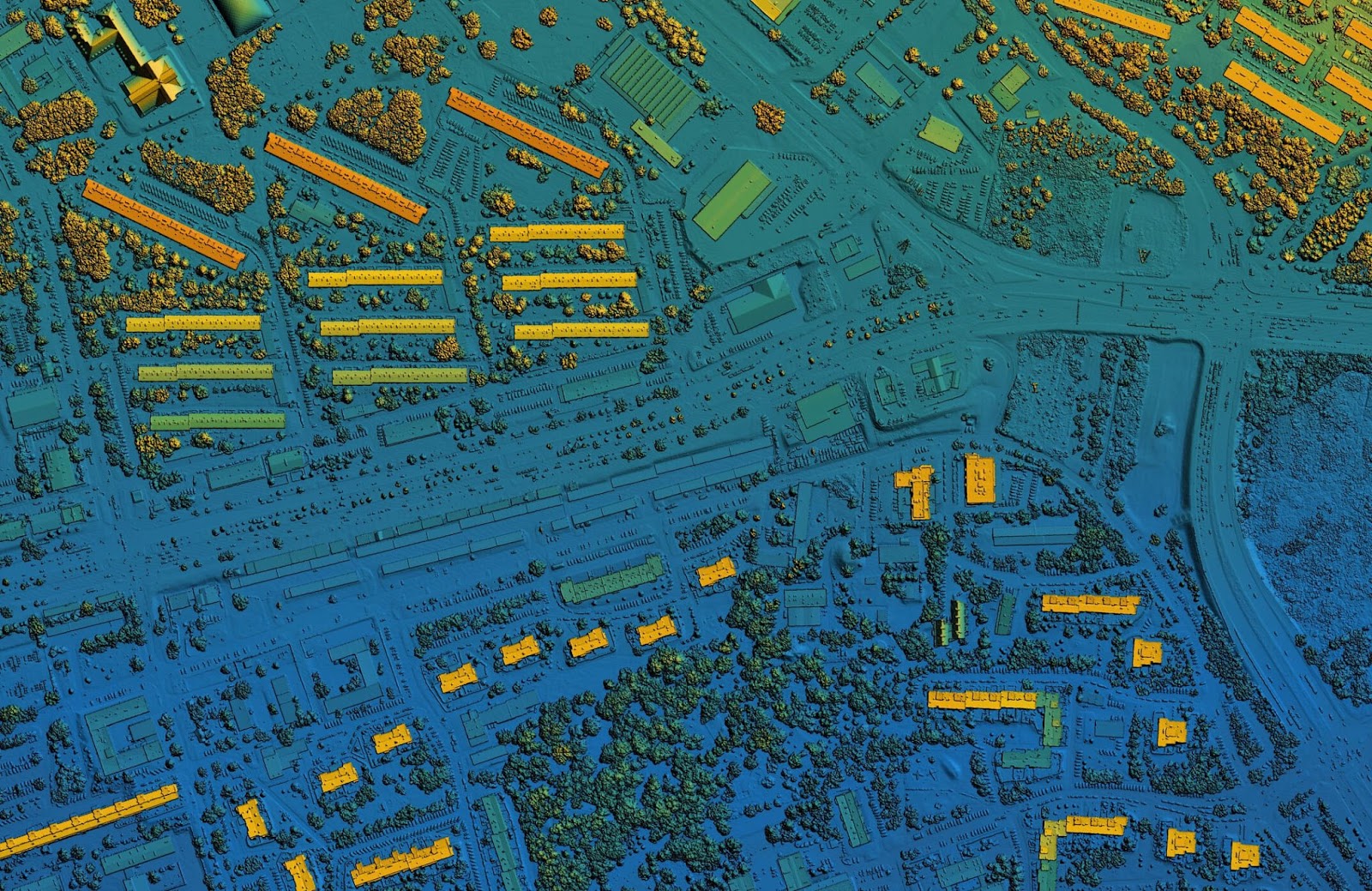
How does aerial lidar technology work? Learn about several types of lidar, their different scanning mechanisms, and more in our in-depth review of these powerful sensors. Elevate your understanding of aerial Lidar for precise mapping and gain insights into its advantages and challenges.
Read Full Story%20(1).png)
Explore our comprehensive guide to aerial survey equipment. From airborne lidar to advanced cameras to gyrostabilized mounts, uncover the top technologies shaping our aerial survey industry.
Read Full Story.png)
The Phoenix Lidar Systems Ranger series covers the spectrum from the lightweight lidar for UAV up to powerful lidar for small fixed wing aircraft. So how do you decide which is the right scanner system for your business? This article features our thoughts on three of the most popular and powerful lidar systems: Ranger-XL, Ranger-Ultra, and Ranger LR LITE.
Read Full Story
What is it like to be a Survey Pilot? We caught up with Michael Intschert, President of Talos Aviation, Stephen Ambagis, owner of Resource Mapping Hawaii, and Aaron Schepers President of Cornerstone Mapping, Inc., to chat with them about what a typical flying day in their lives looks like.
Read Full Story
Is it better to have one top-of-the-line sensor or multiple sensors? How might point cloud accuracy compare between sensors on the same project? Do you want to provide the most accurate data for your clients, or just enough accuracy? Read the rest of this article to answer these questions.
Read Full Story
NingJun You, our VP of sales in EMEA/APAC, grew up in poverty in Wuhan China, developed a love for engeneering from his father which brought him to his expertise in aerial survey equipment today. His story is fascinating!
Read Full Story
A personalized case study on AERIALSURVEY.com growth from keyman startup to growing global business buying, selling, and leasing aerial survey equipment.
Read Full Story
The history of the geospatial industry is complex, there is so much information to learn. I invite you, the reader, to read this article whether you have been in this industry for 40 years or you are brand new like me. See if you learn something new!
Read Full Story
So, you want to buy your first lidar. Here are 4 things to know when buying your first lidar.
Read Full Story
Our philosophy is that our business is about people, not equipment.
Read Full Story
We are excited to announce an addition to the AERIALSURVEY.com team, NingJun You will be our VP of Sales for EMEA and Asia Pacific.
Read Full Story
Do you know the best time and best way to sell your aerial survey equipment? At AERIALSURVEY.com we can help you with your exit strategy.
Read Full Story
AERIALSURVEY.com launches a new and improved website, featuring pre-owned equipment such as lidar, cameras, survey aircraft, mobile mapping systems, and more.
Read Full Story
“The combination of our marketing efforts under a single website offers an exciting opportunity to strengthen and expand our service offering” explains Patrick McConnell, founder and President of ClearSkies Geomatics.
Read Full Story
